Implementation of GI and GIS in municipal Emergency Management May 2007
Implementation of Geographic Information and Geographic Information
Systems in municipal Emergency Management
Research report
May 2007
Michaël Le Duc
Geoinformatics
Royal Institute of Technology (KTH)
michael@leduc.se
Åke Sivertun
IDA
Linköping University
akesiv@ida.liu.se
Implementation of GI and GIS in municipal Emergency Management May 2007
Summary
The project reported concerns Emergency Management (EM) for local government especially Geographic Information (GI) and Geographic Information Systems (GIS). The questions investigated were: How can municipalities implement the use of Geographic Information and Geographic Information Systems for Emergency Management
effectively? How can risk analysis be implemented with a special focus on support from GI and GIS? The purpose of the project is to, based on prior knowledge, develop and, to some extent, validate in a scientific study principles for implementing GI and GIS for EM in municipalities. The theoretical framework used is mainly based on the concepts of adoption of innovations and implementation principles for GIS in municipalities. Innovation adoption is seen as a process composed of several phases. In addition,
potential adopters use a set of criteria to evaluate an innovation. There are many types of innovations, including incremental and radical innovations. Regarding software and information systems, different professionals in a municipality can adopt different modules. We performed interviews with two groups of respondents, namely municipal GIS Coordinators and Emergency Preparedness Officers. Some professionals responded by e-mail. Approximately twenty-five respondents from seventeen municipalities participated. Two metropolitan local governments, nine large cities and other municipalities all across Sweden contributed with information.
The results are very rich and complex. We asked for example Emergency Preparedness Officers to rate their municipality’s GIS maturity, which was perceived as decent. On the other hand, GIS is in limited use for risk and vulnerability analysis in many of the studied local governments (ten). It was interesting to note that no respondent answered that GIS was not compatible with risk and vulnerability analysis but several were uncertain. Seven professionals consider GI and GIS compatible with risk and vulnerability analysis, thus indicating that with time GIS adoption has the potential to increase for risk and
vulnerability analysis. Five respondents do not know how compatible GI and GIS are with risk and vulnerability analysis. The persons in this group have rated GIS use for risk and vulnerability analysis as low, which is consistent with prior research. Education and training in the area were mentioned many times as needed. In addition, exercises are essential for emergency preparedness.
Keywords: Implementation, innovation adoption, municipalities, emergency management, GIS, standardization, risk and vulnerability analysis
Implementation of GI and GIS in municipal Emergency Management May 2007
Contents
Introduction ... 1
Investigated questions and purpose ... 1
Issues ... 1
Purpose ... 1
Project organization and acknowledgements ... 2
Theoretical framework ... 2
Adoption of innovations ... 3
Some research in GI and GIS that has used an innovation perspective ... 5
Further implementation principles ... 5
Methodology ... 8
Design of data collection ... 8
Sampling of respondents ... 8
Telephone interviews ... 9
Processing and analysis of data ... 9
Critique of method ... 10
Critique of theory ... 10
Interview results ... 12
Interviews with municipal Emergency Preparedness Officers and similar occupations ... 15
Question 1. How many inhabitants live in the municipality? ... 15
Question 2. To what extent is GIS used in the municipality? ... 15
Question 3. To what extent is Geographic Information used for risk and vulnerability analysis? ... 16
Question 4. To what extent is GIS used for risk and vulnerability analysis? ... 17
Question 5. Which geographic information is used in risk and vulnerability analysis? ... 18
Question 6. Have you decided recently to use some other geographic information for risk and vulnerability analysis? ... 20
Question 7. If you answered yes in question 6, which geographic information is concerned? ... 20
Question 8. Do you know more geographic information that could be useful for risk and vulnerability analysis? ... 20
Question 9. What motives are for and against using the geographic information that you mentioned in question 8? ... 21
Question 10. Is there geographic information that you have used previously and that you have stopped using? ... 22
Question 11. What motives can be said to have founded the decision not to use the information? ... 23
Implementation of GI and GIS in municipal Emergency Management May 2007
Question 12. Can you on a general level account for the advantages and
disadvantages with using digital geographic information in the context of risk and
vulnerability analysis? ... 23
Question 13. Which geographic information is of special interest? ... 24
Question 14. Which geographic information is less interesting? ... 25
Question 15. To what extent are geographic information and GIS compatible with how you work with risk and vulnerability analysis? ... 26
Question 16. To what extent are geographic information and GIS compatible with the information system that is used for risk and vulnerability analysis? ... 27
Question 17. Have you experienced problems with the complexity of geographic information and GIS in relation to the users? ... 28
Question 18. Please comment question 17. ... 28
Question 19. Have you had the possibility to try geographic information and GIS for risk and vulnerability analysis? ... 29
Question 20. To what extent has that influenced your decision to use geographic information and GIS? ... 29
Question 21. Has the experience of other municipalities influenced your decision to use geographic information and GIS?... 30
Question 22. In what way have you been influenced by the experience of others? . 31 Question 23. Did vendors influenced your choices? ... 31
Question 24. Through which information channels do you learn of other’s experience concerning risk and vulnerability analysis, geographic information and GIS? ... 32
Question 25. How can you assure that emergency preparedness is adequate regarding different types of crises with support of Geographic Information and GIS? ... 33
Question 26. How could you assure that emergency preparedness is further improved regarding different types of crises with support of Geographic Information and GIS?... 33
Question 27. Do you have any further comments? ... 34
Interviews with municipal GIS coordinators and similar occupations ... 35
Question G1. How many inhabitants live in the municipality? ... 35
Question G2. In what way can the Swedish land survey (Lantmäteriet) support municipalities regarding the use of geographic information to support emergency management? For example to develop support before, during and after a crisis. .... 35
Question G3. In what way can the Swedish land survey support your municipality regarding the use of geographic information to support risk and vulnerability analysis? For example to develop support before, during and after a crisis. ... 37
Question G4. Which departments and municipal companies are most receptive regarding geographic information and GIS for emergency management? Why? .... 38
Implementation of GI and GIS in municipal Emergency Management May 2007
Question G5. Which departments and municipal companies are most receptive regarding geographic information and GIS for risk and vulnerability analysis? Why?
... 39
Question G6. Which departments and municipal companies are least receptive regarding geographic information and GIS for emergency management? Why? .... 39
Question G7. Is there cooperation between departments and in what form? ... 39
Question G8. Is there a lack of knowledge in some areas? ... 41
Question G9. How can the lack of knowledge be improved? ... 41
Question G10. In what way has top management support influenced implementation? ... 42
Question G11. Is there a clear strategy regarding the municipality’s use of GIS for emergency management? ... 42
Question G12. Are there champions that have influenced the implementation of geographic information and GIS in emergency management, especially risk and vulnerability analysis? Please discuss. ... 43
Question G13. Can you discuss the availability of resources, e.g. for education and training? ... 44
Question G14. Have hardware and software created any problems, e.g., usability problems, hard to find information, problems exchanging information, etc.? ... 44
Question G15. Is there enough relevant information? ... 45
Question G16. How does standardization of data influence? ... 46
Question G17. How can you assure that emergency preparedness is adequate regarding different types of crises with support of Geographic Information and GIS? For example with exercises. ... 47
Question G18. Are there factors that have not been mentioned in our questions that are essential in implementing geographic information and GIS for municipal crisis management/emergency management, especially risk and vulnerability analysis? . 48 Question G19. Is there something missing? ... 49
Selected summaries of results by respondent ... 50
GIS coordinator of metropolitan local government C (METRO_CG) ... 50
Emergency Preparedness Coordinator for municipality K (Other25_KS) ... 51
GIS Coordinator for municipality K (Other25_KG) ... 52
Emergency preparedness coordinator of the Federation of Fire and Rescue Services Q (FFRS_QS) ... 53
Discussion ... 55
The innovation adoption perspective ... 55
Implementation principles ... 57
Conclusions ... 63
Implementation of GI and GIS in municipal Emergency Management May 2007
Introduction
This report is a result of a research project in Emergency Management for local
government in Sweden, especially regarding support from Geographic Information and Geographic Information Systems.
We initially intended to carry out a case study in one municipality. However, it was difficult to find a suitable municipality willing to participate for various reasons. Instead, we performed semi-structured telephone interviews and obtained some of the answers by e-mail. One advantage with this approach is that we have obtained rich information from a number of municipalities of varying sizes and subject to different circumstances (risk of floods, proximity to nuclear plant, existence of port, motorway with heavy traffic, etc.). A disadvantage with the chosen method is that a time and process dimension is difficult to document and analyze in contrast to case studies.
Investigated questions and purpose
To plan the details of the project it was important to agree on the precise issues and purpose as well as to focus on which expected results and analyses that were most relevant and realistic. The use of innovation adoption and implementation theories were essential in guiding the research project.
Issues
The main questions investigated in the project were:
• How can municipalities implement the use of Geographic Information and Geographic Information Systems for Emergency Management effectively? • How can risk analysis be implemented with a special focus on support from
Geographic Information and Geographic Information Systems?
Note that complete needs and requirements analyses for a specific municipality were not intended.
Purpose
The purpose of the project was to, based on prior knowledge, develop and, to some extent, validate in a scientific study principles for implementing Geographic Information and Geographic Information Systems for Emergency Management in municipalities.
Implementation of GI and GIS in municipal Emergency Management May 2007
Note that the focus is on the local level although in Emergency Management the regional level is important. In addition, some municipalities share fire and rescue services with neighboring municipalities in the form of federations.
Project organization and acknowledgements
The project was funded by the Swedish Emergency Management Agency with management from the KRIS-GIS project at the Swedish Land Survey (Lantmäteriet). Solgerd Tanzilli, Arne Bergquist, Sven Gilland and other colleagues from the Swedish Land Survey have supported the project significantly with knowledge, enthusiasm and important feedback. Michaël Le Duc has performed the main research effort including scientific project management, theory development, research design, main data
collection, data analysis and report writing. Åke Sivertun has contributed with significant contacts and data collection as well as comments on the report. Finally, and not the least, we thank the respondents with their valuable contributions.
Theoretical framework
Emergency Management (EM) in local and regional government is a complex
phenomenon that can be investigated with many different perspectives. Note that the aim of this chapter is not to perform a complete review of relevant literature. The
implementation and use of geographic information (GI) and Geographic Information Systems (GIS) in local government are nowadays also complex phenomena with many agents involved that have varying background, knowledge, responsibilities and tasks. The combination of GI, GIS and EM is thus even more challenging, e.g., that the EM cycle (preparedness, response, recovery, and mitigation) works effectively and efficiently. Stallings (2002) denotes the aforementioned phases of the EM cycle as “activity clusters” or “patterns of behavior”, which is fruitful to encompass their complex nature.
Additionally, building and maintaining appropriate GI databases at all levels
(international, national, regional and local levels) for EM are costly, complex and time consuming endeavors, e.g., regarding detailed digital terrain models for flooding analysis. Theory in the domain can be developed by collecting interview or questionnaire data from practitioners, e.g., decision makers, EM professionals and GIS professionals, as well as reading literature based on such investigations of an inductive nature. Theory based on observation is also an option in the methods repertoire. However, to explain phenomena in the investigated domain, scientific theory can be of great value from disciplines such as psychology, pedagogy, economics, sociology as well as the natural and technical sciences. Scientific theories have certainly their limitations. They can be complicated to understand and use as well as even sometimes unsuitable depending on
Implementation of GI and GIS in municipal Emergency Management May 2007
the context1. Thus, a mix of professional and scientific knowledge is relevant in studying complex and applied areas including the domain of the project.
In the database ScienceDirect from the publishing company Elsevier currently in February 2007, over 8 million full text scientific articles can be accessed with a web browser. Among these articles, only 129 items contain the exact search term “Emergency Management” in the title (2007-02-16). In contrast, a search for articles with
“implementation” in the title yields approx. 7.000 articles with obviously exceptionally diverse topics.
A theoretical framework was devised related to the diffusion and adoption of innovations as well as implementation of GIS and similar technologies in organizations. The elements on adoption of innovation stem mainly from the work of Everett M. Rogers (1995), which is supported by many scientific empirical studies, in the thousands according to Rogers (1995), during decades of research. We also have added other relevant factors for the data collection from the literature and our experience, including the experience of Lantmäteriet.
Adoption of innovations
The part of the theoretical framework included in this section is mainly based on a conference paper on Innovation Management in Computer Software and Services (Le Duc, 2000). According to Rogers (1995, p. 11) “an innovation is an idea, practice, or object that is perceived as new by an individual or other unit of adoption”. Rogers (1995, p. 10-11) defines innovation diffusion as ”the process by which an innovation is
communicated through certain channels over time among the members of a social system. The four main elements are the innovation, communication channels, time, and the social system …. These elements are identifiable in every diffusion research study, and in every diffusion campaign or program.” The social system can be the global EM system or a local EM organization. Communication channels include the internet, seminars, conferences and informal contacts. The diffusion process over time for a successful innovation typically forms an S-shaped curve (Foster, 1986) with slow adoption in the beginning and faster adoption in the middle leading to saturation where the adoption level stabilizes. When an innovation is no longer useful it is typically replaced by a better
1The metaphor of procrustean science is noteworthy. "In Greek legend, a robber called Procrustes had an
iron bed, known as 'Procrustes' bed.' He had the unpleasant habit of forcing his victims to lie on the bed, demanding that they fit perfectly. If they happened to be too tall, Procrustes cut their feet off; if they were too short he had them stretched ... Procrustean science limits the scope for innovation and development; it preserves the status quo.” (Gummesson, 1991, pp. 54-55)
Implementation of GI and GIS in municipal Emergency Management May 2007
alternative, however not always in a complete manner, e.g., there are still lovers of vinyl records.
According to Rogers (2005) the role of the user, or other adopting unit, is crucial. Adoption is a key concept in the innovation literature. Rogers (1995) also terms it the innovation-decision process, which “is the mental process through which an individual (or other decision-making unit) passes from first knowledge of an innovation to forming an attitude toward the innovation, to a decision to adopt or reject, to implementation of the new idea, and to confirmation of this decision.” In other words, Rogers (1995) conceptualizes five steps in the adoption process: (1) knowledge, (2) persuasion, (3) decision, (4) implementation, and (5) confirmation.
Rogers (1995) has identified five pivotal characteristics that determine the adoption of an innovation. (1) Relative advantage is the degree to which an innovation is perceived by a potential adopter as being better than the idea it supersedes (Rogers, 1995, p. 212). (2) Compatibility “is the degree to which an innovation is perceived as consistent with the existing values, past experiences, and needs of potential adopters” (Rogers, 1995, p. 224). (3) Complexity concerns the degree to which an innovation is perceived as relatively difficult to understand and use (Rogers, 1995, p. 242). (4) Trialability has to do with how much the potential adopter can experiment with the innovation. (5) Observability is associated with the degree to which the results of an innovation are visible or communicated to others.
The innovation adoption process in the area of software and information systems has been analyzed extensively in the research literature, e.g., Cooper and Zmud (1990) for an influential article, Lai and Malapert (1997) for a meta-analysis of relevant scientific articles, Wildemuth (1992) on the adoption of intellectual technologies such as software, Barnett and Siegel (1988) and, on client/server technology adoption, Chengalur-Smith and Duchessi (1999).
Other dimensions in the software adoption process in an organization mentioned is the role of top management support, the role of innovative champions (Beath, 1991), available slack resources, etc.
Software adoption in organizations has some distinctive characteristics such as the following aspects. Fichman and Kemerer (1995) discuss for example the “assimilation gaps” that portray the difference over time between acquisition of software and
deployment. Jurison (1993) has found in a study on office information systems that software adoption varies over time and by the type of profession involved (managers, project engineers, professionals and secretaries). E-mail was shown in the study to be highly adopted over time (3 years) and among all studied professions. In contrast, project management software had a low and decreasing average adoption level in the studied
Implementation of GI and GIS in municipal Emergency Management May 2007
population. Adoption of project management software was limited to project engineers. Anyone using an office suite such Microsoft Office or Open Office knows that not all functions are used by everyone. The package or bundle targets a number of user categories. The problem in software package design that significantly differentiates it from software consulting services is that the design of the software must target the total market with all the different user groups.
A GIS for a large or medium sized municipality can have many user groups and many different applications for water supply, sewage, waste management, street maintenance, planning, Fire and Rescue Services, etc. Consequently, the user groups may adopt the different parts of the GIS in varying extents, e.g., data capture, database searching and spatial analysis for EM. In addition, this diversity may add complexity and impact usability negatively.
Le Duc (2000) discusses also, based on literature, so-called network effects, e.g., demand side increasing returns to scale, which in a simplified manner means that the more people use software package the more valuable it becomes. For example, users of the same software package can easily exchange files with each other and do not have to learn a new software if they switch employer. If all software in each category would be totally standardized and open the situation would be different, but we are not in that situation regarding GI and GIS. Shapiro and Varian (1998) are widely cited economists in the area of network effects such as lock-in and other relevant concepts. In the area of
technological standards, sometimes standards wars emerge (Shapiro, and Varian, 1999). Network effects can additionally be related to Rogers’ concept of observability regarding innovation adoption.
Some research in GI and GIS that has used an innovation
perspective
Zorica Nedovic-Budic at the University of Illinois, Urbana-Champaign, has used an innovation perspective regarding implementation of GIS, e.g., Budic (1994), Cavric et al. (2004), Nedovic-Budic (1997; 1998) as well as Nedovic-Budic and Godschalk (1996). Tai On Chan and Ian P. Williamson from the University of Melbourne in Australia use an innovation perspective regarding GIS diffusion, e.g., Chan and Williamson (1999a and 1999b).
Further implementation principles
Prior studies, besides the aforementioned, which can contribute with theoretical insights and eventually data for comparison include the following.
Implementation of GI and GIS in municipal Emergency Management May 2007
In the GIS area, Campbell (1992) and Obermeyr (1990) can be of further interest regarding implementation.
Therese Söderman in her bachelor’s thesis at Mälardalen University (Söderman, 2000) investigated facilitating and inhibiting factors regarding implementation of GIS in municipalities. Michael Le Duc was her supervisor and provided her with literature but she also found other interesting sources. Therese Söderman created a model based on literature with the following factors.
Success factors Obstacles
• Attitude of management
• Availability of GIS database to the organization
• Users’ motivation • User satisfaction • Education and training • System use
• How fast implementation generates tangible benefits
• Standardized systems
• The existence of an IT strategy where GIS is included
• Standardized data
• How fast utilization is diffused in the organization
• How quickly data is captured • The existence of needs and
requirements analysis with user participation
• The use of cost-benefit analysis before and after implementation
• Lack of appropriate knowledge among the personnel
• Lack of understanding among decision makers
• Cost of data
• Lack of coordination among the organizations
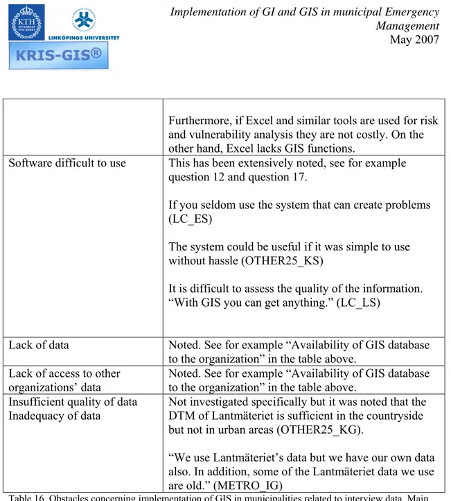
• Cost of software and hardware • Software difficult to use • Lack of data
• Lack of access to other organizations’ data
• Insufficient quality of data • Inadequacy of data
Table 1. Success factors and obstacles concerning implementation of GIS in municipalities. Source: Söderman (2000)
Regarding data quality for example effective flood analysis is very dependent on a suitable Digital Terrain Model of sufficient precision (Lantmäteriverket, 2005) which is lacking largely in Sweden.
The Swedish government project StrateGIS (2003) has identified a number of factors and steps in implementing GIS in municipalities, including the following advice.
Implementation of GI and GIS in municipal Emergency Management May 2007
• You should start with the organization’s information needs • The access to geographic data is critical
• Take a bottom-up approach, gradually building functions that are more advanced • Secure top management support
• A GIS strategy that comprises GIS implementation issues is recommended • Training is necessary
• As soon as personnel have participated in courses, they need to practice their new knowledge using a GIS
• The municipal GIS coordinator is an important person that needs proper knowledge, time, and authority
• In addition, a working group for GIS composed of persons from different departments can help
• Finally, implementation has to be carefully planned
In the area of IT implementation in organization in general (not specifically GIS related), a wealth of knowledge is available. For example, Ramamurthy and Premkumar (1995) investigate organizational factors regarding implementation of Electronic Data
Interchange (EDI). The factors include some of the innovation adoption factors
mentioned above from Rogers (1995) as well as top management support, task scope, IT maturity, organizational learning process and suitable project managers/champions. Note that we had to limit the number of questions in the interviews. Therefore, we did not investigate all the variables and dimensions above.
Implementation of GI and GIS in municipal Emergency Management May 2007
Methodology
The case study method was initially intended to be used. This means that the research team collects data and analyses an organization in-depth with different sources of
information such as documents, interviews, sample geographic data, observation, etc. In a case study a time dimension is of special interest, e.g., how an organization has learnt how to use Geographic Information and Geographic Information Systems in Emergency Management in successive steps or phases. It is important to decide if the time dimension is relevant and possible to investigate in such a research project. In that case, documents are important, e.g., for agents to remember events and change processes.
Unfortunately, it was difficult to find a suitable municipality that was willing to
participate in a case study for various reasons. Our impression during the project was that managers in the field of emergency management at the local level in Sweden are very busy.
Moreover, we thought after a number of months that semi-structured telephone
interviews with a number of municipalities could yield an interesting overview to use our theoretical framework and identify elements for further scientific and professional work. One significant aim with a qualitative method such as semi-structured telephone
interviews is to generate information including information to add elements to and eventually revise the theoretical framework used. The results of a qualitative
investigation can also be used as a basis for a mail survey using statistical methods if that option should be of interest in the future.
Design of data collection
Another key issue is how to use available resources in a project to obtain the best possible information for analysis. The formulation of a theoretical research framework is crucial in this respect. The two questionnaires used were based largely on the theoretical framework.
The professionals obtained the questionnaires and an introductory letter by e-mail after accepting by phone to receive these documents. These documents are included in Appendix II, III and IV.
Sampling of respondents
Patton (1990) lists a number of principles that can be used to select respondents in quantitative and qualitative inquiry. The qualitative and purposeful sampling principles
Implementation of GI and GIS in municipal Emergency Management May 2007
include extreme or deviant case sampling, intensity sampling, homogeneous sampling, criterion sampling, opportunistic sampling and sampling politically important cases (Patton, 1990).
It is crucial in any research project to decide carefully where and how to collect data. In our experience, it is paramount that the respondents and stakeholders have sufficient time to participate. The available time of the respondents can limit the nature and quantity of information that is possible to collect.
A qualitative sampling strategy was used. We combined different principles, including sampling by size, variation (risks for flooding, heavy sea traffic with oil tankers, proximity to nuclear plant, etc.) and opportunity, e.g., some potential respondents were difficult to reach.
We performed interviews with two groups of respondents
• Municipal GIS coordinators, or professionals with the equivalent function • Emergency Preparedness Officers, or professionals with the equivalent function
Telephone interviews
Interviews are a very effective way to collect high quality data in implementation studies. The advantage with semi-structures interviews is that the interviewer can be flexible. The drawback is that not the same questions in the exact same phrasing are asked to all respondents.
Telephone interviews were performed mostly at the end of 2006. Some professionals answered by e-mail, e.g., due to time pressure. During the telephone interviews, key phrases were noted in computer software and the conversation was recorded. We did not transcribe the recordings entirely.
We chose to present the results without the names of the municipalities and individuals so people could speak openly and for security reasons. The detailed data with names are kept internal to the project.
Processing and analysis of data
All interview notes were put in software for mind mapping called MindManager. Some notes were entered directly into the mind maps. This enabled us to sort and analyze data in powerful ways, e.g., select all nodes in the mind map containing a certain keyword like training or management support to save into a separate map, making hyperlinks, expand
Implementation of GI and GIS in municipal Emergency Management May 2007
and compress information, etc. In addition, it was easy to see and sort similar statements from different interviewees, code the data into categories, etc.
Critique of method
A weakness in the data collection design of the project is that we could not obtain information from both GIS Coordinators and Emergency Preparedness Coordinators in a number of municipalities.
Some questions were quite complicated due to the complex nature of Emergency Management combined with support from GI and GIS, which could create confusion. There was for example a risk of discussing GI and GIS in general for the municipality vs. specifically for emergency management as well as risk and vulnerability analysis.
Furthermore, a larger sample would have yielded higher validity. The sampling strategy was not as systematic as we would have wished.
In addition, some professionals responded by e-mail. This did not enable us to explain questions, ask complementary questions when something was unclear and support extensive answers like in telephone interviews. Complicated questions are not
particularly suitable for mail surveys since respondents, especially busy people, tend to answer briefly and skip questions.
A mail survey using appropriate statistical sampling would have yielded more statistically precise and valid data.
Interviewing one or two professionals for each municipality yielded data to be interpreted with caution regarding how valid the statements are for the municipality as a whole.
Critique of theory
We are fully aware that the selected theoretical framework does not comprise all possible relevant elements that could be investigated. We had to limit the literature review and select background knowledge that we thought is relevant for the investigated area as well as what has been used in other pertinent research projects.
Complementary perspective can be found in political science, law, business, economics, e.g., cost-benefit analysis, etc.
Implementation of GI and GIS in municipal Emergency Management May 2007
Furthermore, Rogers (1995, p. 100-) warns about the pro-innovation bias, i.e., that an innovation should be diffused and adopted by all members of social system, that it should be diffused more rapidly, etc.
On the other hand with the chosen theoretical perspective, we overcome negative and unproductive views on the agents in the Emergency Management sector, like “resistance to change” and the “not invented here syndrome” perspectives whatever their validity is. If agents do not use GI and GIS, we should understand why and not pass judgment, rank municipalities in some arbitrary classification system, etc.
Furthermore, the chosen theoretical elements might seem too rational and linear.
Organizational change and development are complex, e.g., in the area of implementation and use of GIS in local government (Le Duc, 1996).
Implementation of GI and GIS in municipal Emergency Management May 2007
Interview results
We carried out interviews with municipalities across Sweden of various sizes and other circumstances. In addition, some respondents answered through e-mail due to time pressure, e.g. one person was leaving his position.
Some persons worked in a fire and rescue services federation, thus representing several municipalities.
In addition, some questions were not answered or asked. If a respondent said that he or she did not know much on the questionnaire’s topics there was no point in asking all the questions. For municipalities with little GIS use in EM, there were too many detailed questions. Finally, we are aware that some interview questions are similar, e.g., since we wanted to know about the use of GI and GIS for emergency management in general as well as specifically for risk and vulnerability analysis.
We report the main findings and include some specific information of special interest. To keep track of the specific statements and items the following table is used to link the data we use internally. Furthermore, these codes will enable the reader to see some patterns more clearly in the data. An advantage with qualitative methods is to allow patterns to emerge during data analysis. In addition, the statements of agents can be a rich source of information and insight.
In the two rightmost columns of the table, the code for municipality type is indicated according to the classification of The Swedish Association of Local Authorities and Regions (SALAR), which is described below.
Implementation of GI and GIS in municipal Emergency Management May 2007
The respondent code is constructed as follows. The first part of the code indicates the type of municipality (LC = Large city; Metro = Metropolitan municipality, etc.). The last letter is used to indicate if the person is working with EM (S) or GIS (G). In the middle is the town code from A to Q in alphabetical order.
Municipality or federation of FRS Number of inhabitants (approx.) GIS Coordinator or similar Emergency Preparedness Coordinator or similar SALAR code SALAR category
A 90.000 LC_AG LC_AS 3 Large cities
B 90.000 LC_BS¤ 3 Large cities C >200.000 Metro_CG Metro_CS1 Metro_CS2 1 Metropolitan municipalities D 120.000 LC_DG LC_DS 3 Large cities
E 70.000 LC_ES 3 Large cities
F 80.000 Sub_FS 2 Suburban municipalities
G 120.000 LC_GS1
LC_GS2
3 Large cities
H 50.000 Other25_HG 7 Other municipalities,
more than 25,000 inhabitants
I >200.000 Metro_IG 1 Metropolitan
municipalities
J 80.000 LC_JG 3 Large cities
K 50.000 Other25_KG Other25_KS 7 Other municipalities,
more than 25,000 inhabitants
L 110.000 LC_LG LC_LS 3 Large cities
M 55.000 LC_MG 3 Large cities
N 130.000 LC_NG LC_NS 3 Large cities
O 30.000 Other25_OG 7 Other municipalities,
more than 25,000 inhabitants
P 105.000 FFRS_PS * *
Q 190.000 FFRS_QS * *
Table 2. Municipalities, Federations of Fire and Rescue Services (*) and respondent codes.
Implementation of GI and GIS in municipal Emergency Management May 2007
Classification of municipalities, as of 1 January 2005, according to the The Swedish Association of Local Authorities and Regions (Bengtsson, 2004).
“The following classification of municipalities was made by the Swedish Association of Local Authorities. The municipalities were divided into nine categories on the basis of structural parameters such as population, commuting patterns and economic structure. The categories of municipalities are:
1. Metropolitan municipalities (3 municipalities)
Municipalities with a population of over 200,000 inhabitants.
2. Suburban municipalities (38 municipalities)
Municipalities where more than 50 per cent of the nocturnal population commute to work in another area. The commonest commuting destination is one of the
metropolitan municipalities.
3. Large cities (27 municipalities)
Municipalities with 50,000-200,000 inhabitants and more than 70 per cent of urban area.
4. Commuter municipalities (41 municipalities)
Municipalities in which more than 40 per cent of the nocturnal population commute to work in another municipality.
5. Sparsely populated municipalities (39 municipalities)
Municipalities with less than 7 inhabitants per km2 and less than 20,000 inhabitants.
6. Manufacturing municipalities (40 municipalities)
Municipalities where more than 40 per cent of the nocturnal population between 16 and 64 are employed in manufacturing and industry. (SNI92)
7. Other municipalities, more than 25,000 inhabitants (34 municipalities)
Municipalities that do not belong to any of the previous categories and have a population of more than 25,000.
8. Other municipalities, 12,500-25,000 inhabitants (37 municipalities)
Municipalities that do not belong to any of the previous categories and have a population of 12,500-25,000.
9. Other municipalities, less than 12,500 inhabitants (31 municipalities)
Municipalities that do not belong to any of the previous categories and have a population of less than 12,500.”
Implementation of GI and GIS in municipal Emergency Management May 2007
Interviews with municipal Emergency Preparedness Officers and
similar occupations
Approx. 14 government officials in Emergency Management were interviewed or
responded through e-mail (a few). Most had worked many years in the area (more than 10 years). In two municipalities, two persons responded.
One respondent (FFRS_PS) for a fire and rescue services federation representing services for approx. 100.000 inhabitants said first that he could not answer our questions since they are not using GIS due to lack of resources. Later he agreed to participate in a telephone interview.
Question 1. How many inhabitants live in the municipality?
See table 2.
Question 2. To what extent is GIS used in the municipality?
Possible answers were 1= to a small extent, 5= to a large extent, or don’t know as well as additional comments.
The following indicators were obtained (not for statistical purposes):
Possible answers Number of answers per alternative Respondents 1 1 FFRS_QS 2 1 FFRS_PS* 3 3 LC_AS OTHER25_KS FFRS_PS* 4 9 Metro_CS2 SUB_FS LC_ES LC_DS LC_GS1 LC_GS2 FFRS_PS* FFRS_PS* LC_NS 5 3 LC_BS LC_LS Metro_CS1
Table 3. Extent of GIS use in the municipalities according to the respondents. *: represents several municipalities
Implementation of GI and GIS in municipal Emergency Management May 2007
Some comments included that the extent of GIS use varies between different municipal departments (LC_ES). In addition, GIS is implemented in many other applications (SUB_FS). The technical departments use GIS extensively, while the “soft” departments lag behind said a professional who also has worked as a GIS coordinator for three years (OTHER25_KS).
Question 3. To what extent is Geographic Information used for risk and vulnerability analysis?
Possible answers were 1= to a small extent, 5= to a large extent, or don’t know as well as additional comments.
The following indicators were given (not for statistical purposes):
Possible answers Number of answers per alternative Respondents 1 3 LC_DS LC_GS1 SUB_FS 2 - - 3 8 LC_AS LC_GS2 LC_ES LC_LS FFRS_PS* FFRS_PS* FFRS_PS* Metro_CS1 4 2 Metro_CS2 FFRS_QS 5 2 LC_BS FFRS_PS*
Table 4. Extent of Geographic Information use for risk and vulnerability analysis in the municipalities according to the respondents.
*: represents several municipalities
The flooding analysis has progressed well in one municipality. Michael Le Duc was present at a seminar [when the results were presented of data collection and analysis]. The FRS uses maps regarding risk objects. In addition, existing information used in other contexts is used in emergency management, for example, where homes for elderly people are, the cadastre and inhabitants records. You can ask how many people over 70 years live in a particular block. (LC_AS)
Implementation of GI and GIS in municipal Emergency Management May 2007
“We have worked with some flooding issues. Otherwise we are only just starting”. (LC_NS).
Michael Le Duc mentioned that a new project regarding education and training in the domain is planned, which was seen as relevant by the interviewee. (SUB_FS)
Geographic information is used in analyses regarding building permits (LC_ES).
Question 4. To what extent is GIS used for risk and vulnerability analysis?
Possible answers were 1= to a small extent, 5= to a large extent, or don’t know as well as additional comments.
The following indicators were given (not for statistical purposes):
Possible answers Number of answers per alternative Respondents 1 5 OTHER25_KS LC_DS LC_GS1 FFRS_QS SUB_FS 2 5 LC_BS Metro_CS2 FFRS_PS* FFRS_PS* FFRS_PS* 3 4 LC_ES LC_LS¤ LC_GS2 Metro_CS1 4 - 5 1 FFRS_PS* Don’t know 1 LC_NS
Table 5. Extent of GIS use for risk and vulnerability analysis in the municipalities according to the respondents.
*: answers for several municipalities
¤: However, for the inventory of risks, we could be rated as 4 or 5. (LC_LS)
One person said that he did not know. IBERO is a new system [based on Microsoft Excel] that is early in its development. How systematic the work is performed varies greatly. (LC_NS)
Implementation of GI and GIS in municipal Emergency Management May 2007
“We have not used GIS for risk and vulnerability analysis. It is performed manually. There is a new system from the Stockholm County called IBERO. We will participate in a course on the system. IBERO is not made for entering lots of data. It is a support system.” (LC_AS)
Recently our FRS participated in GIS education and training. GIS is used increasingly. (LC_ES)
“We do not use GIS at all. The system Geosecma is not suitable for those purposes.” (OTHER25_KS)
Question 5. Which geographic information is used in risk and vulnerability analysis?
Here we obtained a wide panoply of answers with many different maps and digital databases mentioned. On a general level, six areas seem to be the main categories mentioned, namely:
• base maps that are used, • risks,
• transportation,
• Fire and Rescue Services, • hydrology, and
• population.
Some municipalities have not used GI extensively in risk and vulnerability analysis. “We have not come to the details of which maps to use” (LC_NS) and “we more or less don’t use geographic information” (SUB_FS). Only a simple tourist map is used (SUB_FS, OTHER25_KS). “We will use tomorrow a regular tourist map, if you can call that geographic information, e.g., to calculate water flows” (SUB_FS).
Also mentioned (once if not noted) are the topographic map (1:50.000; OTHER25_KS, LC_LS), a general map at scale 1:100.000, a road map (1:100.000), drawings
(OTHER25_KS), and orthophotos (LC_ES).
One municipality is more advanced (Metro_CS2), they use a 3D primary map with pipes and wires, property information, etc.
We asked another municipality about the use of property information (LC_LS). The person responded that they only use the property name. We also asked the same person about the local population database (KIR), which is not used so much since it is too
Implementation of GI and GIS in municipal Emergency Management May 2007
detailed. The same person said that they use many different maps but not a digital terrain model. However, they are interested in that information.
Regarding risks, several persons mentioned “risk objects”, “objects to protect” and similar terms (LC_GS2, FFRS_QS, LC_LS, LC_GS1, LC_ES, FFRS_PS). One respondent (LC_LS) explained that risk objects include “injury on third party”, the oil port, the airport, and industries. Objects to protect include moreover hospitals, childcare facilities, water reservoirs, water plants and heating plants (LC_LS). Also accident information, explosive substances, flooding and bird flue were mentioned. Several people mentioned landslide risk areas (Metro_CS1, LC_GS1).
Hydrology was of interest, e.g. regarding flooding (FFRS_QS, Metro_CS1, LC_AS, LC_NS, LC_ES). Water bodies to protect are also relevant (Metro_CS1). One
interviewee working in a coastal municipality mentioned a project regarding dam disaster modeling affecting a large river with substantial population affected. They used maps at scale 1:250.000 all the way from the mountains to the coast (LC_ES).
Only two persons mentioned population (LC_ES, LC_GS2).
Transportation was also mentioned (LC_GS1, Metro_CS2, FFRS_PS), e.g., regarding transport of hazardous material and maps of the road network and traffic flows (Metro_CS2).
Information for the Fire and Rescue Services include where water for fire fighters is available (FFRS_QS) and planning support for rescue operations (LC_ES).
Implementation of GI and GIS in municipal Emergency Management May 2007
Question 6. Have you decided recently to use some other geographic information for risk and vulnerability analysis?
Possible answers were yes or no. Possible answers Number of answers
per alternative Respondents Yes 1 LC_ES No 10 LC_BS Metro_CS2 Metro_CS1 Sub_FS LC_DS Other25_KS LC_GS1 LC_GS2 FFRS_QS FFRS_PS
Don’t know 1 LC_AS
Table 6. Have you decided recently to use some other geographic information for risk and vulnerability analysis?
We skipped the question for some (for example LC_NS), e.g., due to lack of knowledge. One municipality had recently decided to use new GI for flooding issues. The
professional did not answer yes or no. (LC_LS)
Question 7. If you answered yes in question 6, which geographic information is concerned?
The dam disaster project mentioned in question five was pointed out again (LC_ES). In addition, a high flow flooding project was mentioned, even if it is not launched yet (LC_LS). It was in the early phases so the local government did not know much but consultants are planned to be hired in hydrology and geology. (LC_LS)
We skipped the question for some (LC_NS), e.g., due to lack of knowledge.
Question 8. Do you know more geographic information that could be useful for risk and vulnerability analysis?
Several respondents said that they could not think of more information (Metro_CS2, LC_LS, LC_ES, LC_GS1). Only one person answered clearly “yes” (LC_GS2).
Implementation of GI and GIS in municipal Emergency Management May 2007
The municipality that recently had a project with advanced flooding analysis for a limited area around the main river of the town said that if they had no cost restrictions the
municipality would like to have a detailed terrain model for the whole municipality. It would be of great value for many applications. However, one drawback with this technology is that the model with decimeter accuracy generates too many points. (LC_AS)
Other persons mentioned the value of hydrological maps (SUB_FS), e.g., for flooding analysis (FFRS_PS).
In addition, information on different types of accidents is relevant, e.g., for traffic accidents, people falling and suicides (LC_DS).
Transports of hazardous materials, pipes and wires, landslide information, oil refineries (Metro_CS1), objects to protect like homes for elderly people, hospitals, school, etc. were mentioned.
Furthermore, the cadastre and detailed population database could be relevant (FFRS_QS). The power grid was also mentioned (FFRS_QS and SUB_FS).
Question 9. What motives are for and against using the geographic information that you mentioned in question 8?
One person mentioned that there is nothing against GI, it is providing a good overview and easy to work with in comparison to large quantities of text (SUB_FS).
Another positive account is that “we hope to plan an investment in a system” (FFRS_PS). In contrast, the same person working in a federation of fire and rescue services mentioned many problems, e.g., lack of trained personnel, “municipalities don’t give us data when we ask for them”, “we experience financial cutbacks and the new communication system RAKEL is bad” (FFRS_PS).
Less negative is the official saying, “the only limitation regarding question 8 is that we lack personnel” (Metro_CS1).
One federation of FRSs noted that “the municipalities do not provide us with
information” (FFRS_QS). “We are not able to buy the detailed population and cadastre databases for six municipalities” (FFRS_QS).
Implementation of GI and GIS in municipal Emergency Management May 2007
Furthermore, if you seldom use the system it is difficult to use GI (LC_ES). In addition, “costs are always an obstacle” (LC_AS). Furthermore, the issues of secrecy and personal integrity limit what is possible.
One respondent was quite extensive in this question. He thinks that the area is too big; the available software is not so good. In addition, the different software systems do not work together sufficiently well. Since the law requires that the systems used in crisis do not fail, GIS is not used. A GIS for the cadastre used in the municipality called Geosecma is not interesting at all. It is too detailed. There is furthermore rivalry among the different departments in the municipality regarding which systems to use. Mapinfo was unable to handle AM/FM for water and sewage, so the local government bought Geosecma. In addition, “I cannot use Geosecma in my portable computer”. “Also our web GIS is difficult to use”. “Our GIS coordinator has not much to do!” (Other25_KS)
One respondent thought that the question is difficult to answer, “I am not an expert” (LC_NS).
Question 10. Is there geographic information that you have used previously and that you have stopped using?
Possible answers Number of answers per alternative
Respondents
Yes - - Not as far as I know 2 Metro_CS2
Sub_FS No 5 LC_LS LC_GS1 FFRS_QS LC_DS Metro_CS1
Don’t know 1 Other25_KS
LC_AS LC_ES
Table 7. Is there geographic information that you have used previously and that you have stopped using?
One person said, “GIS is like a heavy truck without wheels” (OTHER25_KS), i.e., he is rather negative.
“Old city maps”/tourist maps were mentioned since they now use orthophotos in color, which is good since you see the vegetation, the topography. Most of the municipality is available in color. (LC_AS)
Implementation of GI and GIS in municipal Emergency Management May 2007
In one case, the system was difficult to use so the project was cancelled (LC_ES).
Question 11. What motives can be said to have founded the decision not to use the information?
Similar statements as above are noted like: • outdated data (LC_BS)
• lack of money and resources (FFRS_PS)
• difficulty in using information and system (LC_ES)
Question 12. Can you on a general level account for the advantages and disadvantages with using digital geographic information in the context of risk and vulnerability analysis?
The advantages mentioned include mainly:
• I can only see advantages, no disadvantages (LC_DS, Metro_CS2, SUB_FS) • It is a good way to have an overview (FFRS_PS, LC_LS, LC_GS2, LC_ES) • Two persons mentioned that it is enjoyable to work with different map layers
(SUB_FS, LC_ES)
• Possibility to search for information on different levels (LC_GS2)
• “With a digital GIS you obtain dynamic information that is updated and improved continuously” (Metro_CS1)
• It is fast and you can choose the information you want (LC_ES) • It is suitable if you work with computers (SUB_FS)
• To use paper binders is not so comfortable (LC_AS)
• “You get lots of parameters that you can handle in a rational way. You get lots of output in relation to a small input.” (LC_AS)
The drawbacks include mainly:
• Personal integrity and secrecy threats (LC_BS, Metro_CS2)
• Electronics requires electricity so they can be vulnerable during outages. You need reserve power (LC_AS)
• Terrorists can strike out computers (FFRS_PS)
• There are problems with different coordinate systems. In addition, you need to remove information from different layers; there is a lot of work to make things work geographically. We want to work with the whole municipality that may lead to problems when things are not ready for the whole municipality. (LC_LS)
Implementation of GI and GIS in municipal Emergency Management May 2007
• Usability problems mentioned include
o If you seldom use the system that can create problems (LC_ES) o Technical skills are required to find information (LC_AS) o The system could be useful if it was simple to use without hassle
(OTHER25_KS)
o The personnel want help continuously by GIS expertise (FFRS_PS) o It is difficult to assess the quality of the information. “With GIS you
can get anything.” (LC_LS)
o We asked one interviewee about limitations of computer screens to display maps. He answered that it can be difficult to scroll the map on the computer screen. That can be a drawback. If you show the whole map on a computer, it is impossible to read. “In that case, we maybe print maps on paper”. (SUB_FS)
One noteworthy comment here is that a respondent said, “it should not be a GIS specialist who develops a system for risk and vulnerability analysis. The person making the risk and vulnerability analysis should control the system” (OTHER25_KS)
Question 13. Which geographic information is of special interest?
Here we obtained answers similar to previous questions. On a general level, the following areas seem to be the main categories mentioned, namely:
• Base maps that are used
o “In urban areas, we use a certain type of maps. In the countryside, we also use the topographic map with other information.” (LC_LS)
• Risks
o Risk objects (FFRS_QS, FFRS_PS) o Risk areas (FFRS_QS, LC_ES) • Transportation
o To optimize the transportation system is interesting for personal cars, trucks and busses (LC_AS)
o Handling transports of hazardous materials (FFRS_PS)
o “We need to handle road classes for heavy trucks and the directions of traffic flows” (OTHER25_KS)
• Fire and Rescue Services
o Statistics on FRS operations are relevant (LC_GS2) • Community resources include
o Hospitals (OTHER25_KS) o FRS stations (OTHER25_KS) o Schools (OTHER25_KS)
Implementation of GI and GIS in municipal Emergency Management May 2007
• Population.
o In different areas how people live (LC_ES)
o We need to know where people with evacuation needs live (FFRS_PS) o How many inhabitants live on an address or part of a building?
(FFRS_PS)
“Everything can be interesting in this context” (SUB_FS). Resource lists have improved. Today’s plans are shorter than before and contain functions (OTHER25_KS).
Some respondent said that they do not know. “I cannot point to some special information” (LC_DS)
“My answer is like in the previous questions” (LC_ES). “Please read my response for question 5 and 8” (Metro_CS1; responded through e-mail). “Here I have to refer you to my answer regarding question 5” (Metro_CS2).
Question 14. Which geographic information is less interesting?
For this question we obtained mainly the following points.
On a general level, “it is difficult to say which information is not relevant” (FFRS_PS). Other interviewees (FFRS_QS, LC_DS) mentioned similar comments. “It is easier to say which information we would like to add” (FFRS_PS).
Some respondent did not know (Metro_CS2).
“Information that is not specific to risk and vulnerability analysis is not relevant” (Metro_CS1).
Specific geographic information mentioned that is not particularly relevant includes: • “City maps, which can be useful in the field but not for planning purposes”
(LC_AS).
• “The specific age of elderly people in a home for the elderly is not interesting, since everybody has to be evacuated” (LC_ES)
• We don’t need information about (SUB_FS) o Buildings
o Leisure paths o Leisure maps o Stadiums o Properties
Implementation of GI and GIS in municipal Emergency Management May 2007
During the discussion for this questions information of interest was mentioned, e.g., • Buildings with cultural and historic value (SUB_FS)
• Road classes for heavy trucks as well as distance information (OTHER25_KS) • Accessibility (OTHER25_KS)
• A simple route planning system could be relevant which includes voluntary persons with motorbike driving permit (OTHER25_KS)
Question 15. To what extent are geographic information and GIS compatible with how you work with risk and vulnerability analysis?
Possible answers were 1= to a small extent, 5= to a large extent, or don’t know as well as additional comments.
The following indicators were given (not for statistical purposes): Possible answers Number of answers
per alternative Respondents 1 - - 2 - - 3 1 LC_LS 4 5 LC_DS LC_GS2 Metro_CS2 LC_ES Metro_CS1 5 1 FFRS_QS
Don’t know 5 SUB_FS
OTHER25_KS LC_NS LC_GS1 LC_BS
Table 8. Extent of compatibility between GI, GIS and work with risk and vulnerability analysis according to the respondents.
“Since we use maps in such limited extent, I don’t know what to answer” (SUB_FS). “We don’t use maps at all” (OTHER25_KS).
“I think GIS and risk and vulnerability analysis are compatible” (LC_AS). “GIS is clearly a natural component” (LC_ES).
It is problematic with information outside urban areas, for example concerning forest fires. We need elevation contours. The topographic map [1:50.000] in vector format is sufficient if we combine it with property boundaries, however the road network is not as good as in the Lantmäteriet national road map. In urban areas, we combine the
Implementation of GI and GIS in municipal Emergency Management May 2007
Question 16. To what extent are geographic information and GIS compatible with the information system that is used for risk and vulnerability analysis?
Possible answers were 1= to a small extent, 5= to a large extent, or don’t know as well as additional comments.
The following indicators were given (not for statistical purposes): Possible answers Number of answers
per alternative Respondents 1 1 OTHER25_KS 2 2 Metro_CS2 LC_ES 3 1 LC_DS 4 5 FFRS_QS LC_LS LC_GS2 FFRS_PS Metro_CS1 5 -
Don’t know 4 LC_AS
SUB_FS LC_GS1 LC_BS
Table 9. Extent of compatibility between GI, GIS and information systems used for work with risk and vulnerability analysis according to the respondents.
“I don’t think that GIS is particularly compatible with the information system we use for risk and vulnerability analysis” (LC_ES).
“[A university close by] has developed a system for risk and vulnerability analysis, but it is not linked to GIS” (LC_ES).
We asked if Microsoft Excel is used to a respondent. “We don’t use a particular system. We use Excel. We use a text-based system. We use the IBERO system that has been developed by the Stockholm County. IBERO does not contain any map module. In the end we get files.” (SUB_FS)
Another professional mentioned that the municipality also uses Microsoft Excel. They also use the software RISKERA that can easily import data from a GIS. It is also possible to link RISKERA with a GIS. However, RISKERA needs to be improved. The
municipality also uses the software LUPP, which is used on an operational level during an event that lasts a long time. However, LUPP has a poor map engine. (LC_LS)
Implementation of GI and GIS in municipal Emergency Management May 2007
Question 17. Have you experienced problems with the complexity of geographic information and GIS in relation to the users?
Possible answers were yes or no. Possible answers Number of answers
per alternative Respondents Yes 5 LC_AS Metro_CS2 OTHER25_KS LC_GS2 LC_ES No 6 LC_NS LC_LS LC_DS SUB_FS FFRS_QS Metro_CS1 Don’t know 2 LC_GS1 LC_BS
Table 10. Has the complexity of GI and GIS in relation to users been noted?
Furthermore, “as I have said earlier, if you don’t use GIS so often, you can experience the problems mentioned” (LC_ES). “You may need to participate in a small course, even if the mentioned problems are not significant” (SUB_FS).
“We use a system to analyze crimes on maps, for example robberies. When you press a button, you obtain information on where the robberies have occurred and at what times. It is easy to use.” (LC_NS)
Question 18. Please comment question 17.
“We don’t have access to the municipalities’ maps or data” (FFRS_QS).
Many comments could be sorted in the area of design and usability. “The system is dominated by experts” (Metro_CS2). “There is a lot to do in this area, to make systems user friendly, you have to improve that a lot” (LC_AS). “It is too cumbersome to use, especially when you have time pressure” (OTHER25_KS). “The problems could be described in a thick novel. GIS is too complicated” (OTHER25_KS). “The people who work with GIS are experts” (LC_AS). “In a crisis situation you become dependent on experts” (LC_AS). One problem is when you use the system too seldom (LC_ES). “We use the software Solen, which requires some training, for example what the words mean” (SUB_FS). “When you investigate the systems you perceive them as complex”
Implementation of GI and GIS in municipal Emergency Management May 2007
“You should not create new organizational models. We use a Web-based GIS which is user friendly” (LC_AS).
“A network of people who work with GIS is missing” (LC_LS). “Portable computers are expensive. It is easier to call a cell phone” (OTHER25_KS).
Question 19. Have you had the possibility to try geographic information and GIS for risk and vulnerability analysis?
Possible answers were yes or no. Possible answers Number of answers
per alternative Respondents Yes 6 Metro_CS2 LC_LS LC_GS2 LC_DS LC_ES Metro_CS1 No 5 LC_BS SUB_FS OTHER25_KS LC_GS1 FFRS_QS Don’t know - -
Table 11. Have you had the possibility to try GI and GIS for risk and vulnerability analysis?
In addition, “I have only seen systems that were put into a graveyard” (OTHER25_KS). “We have made some tests and also met [the power company] Vattenfall for over one year” (LC_ES).
Question 20. To what extent has that influenced your decision to use geographic information and GIS?
Possible answers were 1= to a small extent, 5= to a large extent, or don’t know as well as additional comments.
Implementation of GI and GIS in municipal Emergency Management May 2007
The following indicators were given (not for statistical purposes):
Possible answers Number of answers per alternative Respondents 1 1 LC_DS 2 1 Metro_CS2 3 - - 4 2 LC_GS2 FFRS_PS 5 2 LC_ES Metro_CS1 Don’t know 4 LC_BS LC_LS LC_GS1 FFRS_QS
Table 12. To what extent has the possibility to try GI and GIS for risk and vulnerability analysis influenced the decision to use GI and GIS in that context?
It is a matter of costs. (FFRS_PS)
Question 21. Has the experience of other municipalities influenced your decision to use geographic information and GIS?
Possible answer options were yes or no. Possible answers Number of answers
per alternative Respondents Yes 4 LC_BS LC_AS LC_GS2 FFRS_QS No 7 Metro_CS2 LC_ES SUB_FS LC_LS OTHER25_KS LC_DS Metro_CS1 Don’t know 1 LC_GS1
Table 13. Influence of the experience of other municipalities regarding GI and GIS.
In addition, “A pair of neighboring municipalities are advanced, which has inspired us. However, I am not a GIS expert.” (LC_AS)
Implementation of GI and GIS in municipal Emergency Management May 2007
Question 22. In what way have you been influenced by the experience of others?
One FRS federation is eager to get started as soon as possible. However, “the municipalities stop that initiative”. (FFRS_QS)
A local government representative (LC_AS) gave quite some comments for this question. “You learn by listening to other’s experience, such as other municipalities and the
regional level. You can also observe. With channels such as the mass media and SEMA as well as seminars, you get informed on others’ experiences.” One example mentioned is a municipality with oil refineries on the west coast, which illustrates that you have to adapt the strategy to the different municipalities. (LC_AS)
One person answered that he did not know (LC_GS1). Another person in the same municipality said that he has looked at demos (LC_GS2).
Two respondents said that they have not been influenced by the experience of others (FFRS_PS and LC_DS).
Question 23. Did vendors influenced your choices?
Possible answer options were yes or no. No one answered “yes”.
Eleven respondents answered “no” (LC_BS, Metro_CS2, Metro_CS1, LC_DS, LC_ES, FFRS_PS, SUB_FS, LC_GS2, OTHER25_KS, LC_LS, LC_NS).
One person answered, “I don’t know” (LC_AS).
“I have never talked with a vendor about this. The level is too low. The most common type of software is the one that a user or a researcher has made in a Microsoft Excel spreadsheet. It’s like a dumb, dumb, level.” We asked this person if there is a market. He answered that he is a bit skeptical about computers since they do not work.
(OTHER25_KS)
Finally, another person mentioned that the municipality has used its own experts. (LC_NS).