Ecological adaptation
of roads
Discussion of possible ecological impacts and their
mitigation as appliedto a road project in Sweden (To) (&») (&») qppamd < CT (&p) ( [ab] ad ca fr b] _- «-(«b] e
E
Lennart Folkeson
Swedish National Road and
(Transport Research Institute
VTI meddelande 792A - 1996
Ecological adaptation
of roads
Discussion of possible ecological impacts and their
mitigation as applied to a road project in Sweden
Lennart Folkeson
Swedish National Road and
Publisher Publication
VTI meddelande 792A
Published Project code
. , 1996 80088
Swedish National Road and Project
'Transport Research Institute
Ecological assessment of Highway 31
Printed in English 1997
Author
Sponsor
Lennart Folkeson
Swedish National Road Administration
(SNRA) Southeastern Region
Title
Ecological adaptation ofroads: Discussion ofpossible ecological impacts and their mitigation as applied to a
road project in Sweden
Abstract (background, aims, methods, result)
This report is a contribution to the discussion on ecological adaptation of the road infrastructure and a stage in
the Environmental Impact Assessment (EIA) for a new section (Bogla-Oggestorp, 5 km) of Highway 31 to the
south east of Jonkoping in the south of Sweden. The aim 1s to illustrate the handling of ecological issues in the
EIA and to give a preliminary estimate, for both the tunnel and non-tunnel alternatives, ofthe ecological impact
of the road at the fault scarp near the village of Bogla. The work is based on existing preliminary EIA reports,
general ecological knowledge and international measures for ecological adaptation ofthe infrastructure. Emissions
of HC, CO, NO, and CO, with and without a tunnel were simulated for 1993 and 2004.
The natural values in an area should be assessed using various scales of space and time. On the small spatial
scale, natural values which are destroyed by the road, and disturbance to plants and animals in the vicinity of
the road, are identified. On the larger scale, an assessment 1s made ofthe influence ofthe road on the migration
of animals and the exchange of individuals and genes in and between populations. Assessment of the value of
nature in the area should be based not only on individual species and habitats but also on the large scale features
of the area as a whole. It should be borne in mind that natural values may increase over time and that the value
which society places on nature is subject to constant change. In the absence of a developed methodology for
pricing, it is impossible to put a monetary value on the natural value of areas.
In the study area, the botanical, zoological and geological values, combined with the small scale topography,
form an entity that is of great value for nature conservation. The continuity in time and space of the natural
environment of the fault scarp and Klevaberg forest should be given special consideration.
A road would weaken the landscape-ecological connections, contribute to the fragmentation ofthe landscape
and habitats, and would in the long term threaten rare mosses and lichens. The barrier effect of the road would
be limited if the tunnel alternative were chosen, an animal underpass constructed, provision for wildlife made
in the planned underbridges, and the bridge over Femtingaa@ brook adapted to the migration of terrestrial and
aquatic animals.
According to the simulation, there 1s no difference in exhaust emissions between the tunnel and non-tunnel
alternatives.
Steps should be taken to prevent runoff from the road reaching watercourses and wetlands untreated.
The situation prior to the project should be documented to serve as the basis for the post-project analysis.
ISSN
Language
No. of pages
0347-6049
English
31 + App.
Foreword
This report describes the results of the work performed in the project "Ecological assessment of Highway 31" (VTI Project No 80088). The project manager was Lennart Folkeson, Swedish National Road and Transport Research Institute (VTI), who has written the body of the report. The appendix The new Highway 31, Lidhult-Oggestorp: Estimation ofexhaust emissions and the cost of damage to nature by these has been written by Bo Karlsson of VTL.
The work was commissioned and financed by the Southeastern Region of the Swedish National Road Administration, with Rickard Sandberg as the contact person.
The commission was received at the end of March 1995. A preliminary report (in Swedish, "Bedomning ay ekologiska konsekvenser avy ny Rv 31 Jonkoping
-VTI MEDDELANDE 792 A
Oggestorp'") was submitted on 12 April 1995. A revised version was submitted as the final report on 21 June 1995. Publication was preceded by a seminar on 2 October 1995, with Hans G Johansson, VTI, as reader. This report includes the views expressed at this seminar, while the review of the literature regarding animal underpasses has been removed for publication in another context.
I wish to express my sincere thanks to Hans G Johansson for his scrutiny of the report and to Lewis Gruber for his translation into English.
Linkoping, October 1997
Contents
SUIMIM@TY reese reer se errr rere errr ress ersss errs rer reese rrer reer rrr rrr rr rere I 1 INtLOUGUCTOM reer reese reese serre e errr seers errr reer errr errr reek, 11
I Nor o e 11
oe imenw 11
1.3 AIT@ANG@MENt Of the errr sr rrrrrrrrrrr errr rrr reer erea eee 11
2 uo c 12
2.1 ThG StUQUY rrr srs rere serre rere err ee. 12
2.2 ECOLOGY rere rrr rrr sear rere errr eee e eee 12
2.3 Simulation of exhaust emissions and the cost of damage to nature caused by these ...222.... 13
3 ECOIOGIC@I rrr rrr rrr rere r errr errr rere reer rear ake, 14
3.1 L@Ig@ UNGUIStUIDEQ rre rrr aree reer rere ee. 14
3.2 L@NdSCAPDE @COIOGIC@l COMME@CHOMS rrr rrrrr rer rre reer errr rere rere reek. 14
3.3 LOG@l U1IStUTDANCGE@ rere errr reer rre rere errr errr ekke. 16
3.4 rrr rrr errr rrr rere reer reek ee, 17
3.5 OVEF@Il ASS@SSMENMA serre rere errr rara re ee, 18
4 S1MUIAt1ON Of EXHAUSt CMMSSIOMS errr errr rr rrr errr r rere reer reer reek ke. 19 5 Possibilities of monetary evaluation of environmental eACrO@ACKMENt erea kee. 20 6 Measures for ecolO81C@l @U@PtAtION Of FOAUS rrr rere rere rrr eres esse keke}, 23 23
6.2 ANIMA errr rrr errr rre rere rere errr reer ea ea 23
6.3 BIIG§ES OVEF WAt@TCOUTS@S rere errr rere ree 24
6.4 TIEAIMEAt Of FUNOFfE er errr errr rer rear rere ree een ea 25
7 Recommendations regarding HIGHWAY 31 rrr rrr errs sre seee 26
7.1 ThE AT@A AS A WHOIG rrr errr reer rere rrr errr rre reer rere reer reer rere ees 26 7.2 The temporal @SpPECt; Ch@NG@S 1M AtHEUGG err vre serre rere rere reer rere rrr rrr reer rere 26 7.3 Measures for the PASSAGE Of AMIM@IS errr errr errr errr rere rere ee 27 7.4 Measures in conjunction with the bridge Over FeMtING@A DFOOK rere revere rere rrr rarer eee} 27 7.5 HyYQrOIOGICG@ALCOMAUIHONMS verre srs serre reer errr errr errr rr errr e 28
7.6 TrEAtMENt Of LOAQ FUNOFE errr rrr rrr serre errr errr rake ea 28
7.7 Measures in coOnJUunCt10N With rO@Ad CONStUCHIOM verre rere rrr errr rre rrr r re 28 7.8 Augmentat10n Of the N@tULE rere srv verre rr errr rere reer rere reer errr errr errr 29
7.9 FOIlOW-UP rrr rere rr errr rrr rere rr rrr ees 29
8 REf@TE@MCES rrr errr rrr rere r er rrr rara 30
errr rer reer rere rere errr reer ea 31
Appendix:
Bo 0 Karlsson: The new Highway 31, Lidhult - Oggestorp:
V I
Estimation of exhaust emissions and the cost of damage to nature caused by these
Ecological adaptation of roads: discussion of possible ecological impacts and their mitigation as applied to a road project in Sweden
by Lennart Folkeson
Swedish National Road and Transport Research Institute (VTI) SE-581 95 Linkoping Sweden
Summary
This report discusses methods of handling ecological issues in the Environmental Impact Assessment (EIA) of roads. The discussion is applied to Highway 31 in the south of Sweden where the EIA for a new 5 km section (Bogla-Oggestorp) of the road is in progress. On the basis of general ecological knowledge, published surveys of the literature and preliminary EIA reports, the possible ecological effects of this road with and without a tunnel under Klevaberg mountain are discussed. Mitigation methods which are relevant to Highway 31 are also discussed. In an Appendix, the results of simulations of the emissions of HC, CO, NO, and CO, by traffic on the Lidhult-Oggestorp section, with and without a tunnel, are given for the years 1993 and 2005. The standardized costs of damage to nature caused by exhaust emissions have also been calculated.
The study area comprises the fault scarp near the village of Bogla (south of the town of Huskvarna, Jonkoping County), the relatively little disturbed forest area east of the scarp (the Klevaberg area) and part of the agricultural district surrounding brook to the south of Lake Stensjon. Certain parts of the fault scarp and Klevaberg forest contain woodland key-habitats, with a number of red-listed mosses and lichens. The fauna in the area includes eagle owl, curlew and otter. Klevaberg forest is rich in game and has some features of a natural forest.
In the EIA, various scales in time and space should be applied in describing the natural values of an area and in estimating how these may be affected by a road. On the small spatial scale, the natural values which are more or less directly affected by the road should be identified. Great importance should be attached to woodland key-habitats and red-listed species. Disturbance to plants and animals in the close vicinity of the road, and the impact on the groundwater table and other hydrological conditions, should also be identified and described. On the somewhat larger scale, an assessment must be made of the influence of the road on the continued exchange of individuals and genes in and between populations severed by the road. The effect of the road on the long-range migration and dispersal of specific animals must also be assessed. Other types of landscape-ecological relationships must also be considered, as well as the extent
VTI MEDDELANDE 792 A
to which the addition of a single road contributes to the continuous large-scale fragmentation of the landscape. The final appraisal should comprise an overall assessment of all the natural values of the area. In this context, it 1s important to bear in mind that both the "actual" and the "perceived" natural values change over time. The biological value of an old forest, for instance, increases as time passes. At the same time, there is also a time-related change in the view that society has regarding the value of different types of nature. In the absence of developed methods of pricing, it 1s impossible to express in monetary terms the total natural value of an area.
The following preliminary assessments and recommendations can be given concerning the specific study area:
e The value of the area from a biological/ecological point of view consists not only in the occurrence of a number of rare, threatened or care-demanding species. Within this area, the botanical, zoological and geological values, combined with the landscape-ecological features and a high degree of variation in topography and land use, form an entity that has great value for nature conservation.
e Special attention should be paid to the continuity in time and space of both nature in the fault scarp and Klevaberg forest.
e A road in the area would impair the landscape-ecological connections, especially in the fault scarp, and would cause fragmentation of the surrounding forest areas which have long continuity in time and space.
e The road would probably have a disturbing influence on certain sensitive animals. In the long term, the road may threaten certain rare mosses and lichens in the area.
e A tunnel would limit the encroachment on the fault scarp, mitigate the barrier and fragmentation effects, and better satisfy conservation interests at the fault scarp and in Klevaberg forest.
e If no tunnel is constructed, the barrier effect of the road on game and other animals would be mitigated by a man-made animal underpass in Klevaberg forest.
e Underbridges for local minor roads and forestry roads should be sited and designed so as to permit their use by wildlife.
The bridge over Femtingaa brook should be designed so as to permit migration and dispersal of both terrestrial and aquatic animals along the brook. Steps should be taken to prevent runoff from the road reaching watercourses and wetlands without treatment.
According to the simulation, there is no significant difference in exhaust emissions, or in the standardized costs of damage to nature caused by these, between the tunnel and non-tunnel alternatives. However, neither health effects nor costs relating to the barrier effect or the encroachment on natural areas are included in these estimates.
Construction activities which affect watercourses should be timed and carried out so as to minimize disturbance to the reproduction of aquatic animals. Inventories of mosses and lichens should be augmented with inventories of mushrooms, higher plants and fauna in the area, and the limnology of Femtingaa brook and its tributaries.
A follow-up programme should be carried out in cooperation with ecological experts. The environmental conditions prior to construction of the road should be thoroughly documented and made available for this.
1 Introduction
1.1 Background
Highway 31 which is part of the national trunk road system connects Jonkoping with Nass;6 and goes on towards Kalmar. In order that the standard required of a highway should be satisfied, the Swedish National Road Administration (SNRA) has proposed that the Jonkoping-Oggestorp section of Highway 31, where there are "serious shortcomings" in road standard according to the Regional Road Management Plan (Regional vighallningsplan 1994-2003), should be replaced by a new road (Fig. 1). Traffickability is particularly restricted through Tenhult. The Oggestorp-section has recently been upgraded to 13 m standard.
Environmental conditions and environmental impact have been described in previous assessment steps. An environmental impact assessment was made in conjunction with the route selection study (MKB -lokaliseringsstudie 1993). An EIA was also made (Riksvag 31 Delen Ryhov-Oggestorp Miljokonsekvens-beskrivaing 1993) in conjunction with the feasibility study (Riksvig 31 Ryhov-Oggestorp Utredningsplan 1993).
After a number of alternative corridors had been subjected to an outline investigation, six main alternatives remained from the 1993 feasibility study:
1) The do-nothing alternative 2) Northern-Bogla
3) Northern-Bogla with tunnel 4) Southern-Bogla
5) Southern-Tenhult 6) Northern-Tenhult
After the consultation procedure the SNRA made a policy decision according to which most of the above alternatives were deleted and further investigation concentrated on the following three routes:
e The do-nothing alternative e Southern-Bogla with tunnel e Southern-Bogla without tunnel
1.2 Aim and limitation
This work is a contribution to the discussion on ecological adaptation of road infrastructure, and a further
VTI MEDDELANDE 792 A
stage in the ongoing EIA work on the Bogla-Oggestorp section of the new Highway 31. The aim of this work 18
e to contribute to the discussion of how ecological issues can be dealt with in EIA for roads
e to make a preliminary assessment, on the basis of existing environmental impact assessments for the new Highway 31, of the ecological impact of a road scheme according to the Southern-Bogla alternative, both with and without a tunnel
e to assess what action regarding ecological adaptation may be relevant in this case.
The work has been limited to treatment of ecological impact only. Other environmental consequences are not dealt with. Nor is there any attempt made to relate the ecological impact to the overall macroeconomic consequences.
1.3 Arrangement of the report
The way landscape ecological relationships and other natural environmental conditions can be elucidated in assessing the environmental impact of a road project is an issue of central importance in this report. This issue is dealt with in Chapter 3 with special reference to the conditions in the area affected by the Highway 31 Bogla-Oggestorp project. The exhaust emissions and the cost of damage to nature caused by the emissions which traffic on the proposed road section (with or without a tunnel) would generate have been estimated with the model VETO (Appendix and Chapter 4). In many contexts, there is growing demand for monetary evaluation of the environmental encroachment made by a road. Chapter 5 gives a summary presentation of some of the methods tested in this regard. Some damage limitation measures in conjunction with the ecological adaptation of roads, principally in the form of animal underpasses, are described very briefly in Chapter 6. Finally, some recommendations are given regarding the treatment of ecological issues in future EIA work for Highway 31 (Chapter 7). At the end of the report a glossary is given.
2 Methods
2.1 The study area
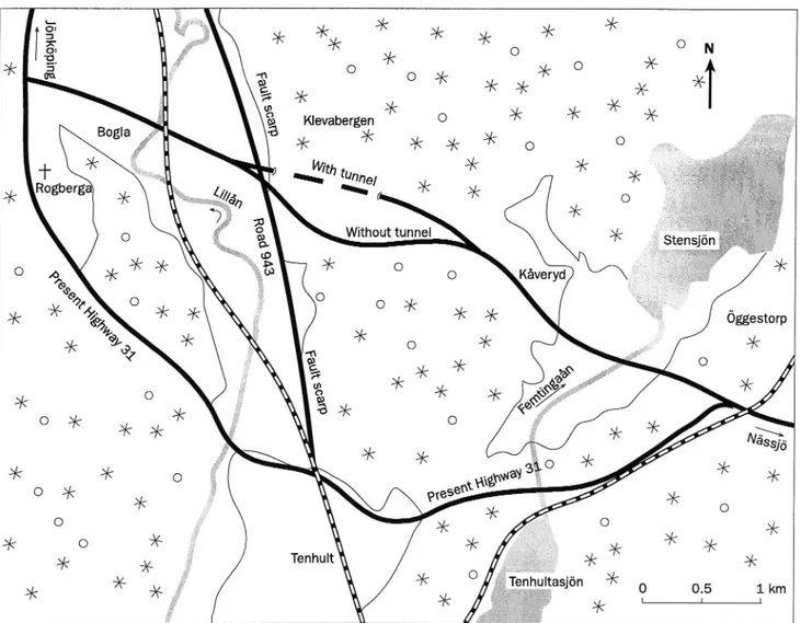
The study area is 10-15 km to the south east of Jonkoping and 2-4 km to the north and the north east of Tenhult (Fig. 1). To the west, the area includes the fault scarp near the village of Bogla, the Klevaberg area, i.e. the forested area on top (to the east) of the scarp, and the northern part of the agricultural area in the valley of Femtingaa brook between Kaveryd, Lake Stengjon and Oggestorp. Road 943 between Huskvarna and Tenhult 1s situated below and to the west of the fault scarp. The present Highway 31 between Tenhult and Oggestorp passes to the south of the study area.
The section of the planned road between Road 943 and its junction with the existing Highway 31 at Oggestorp is about 4.5 km in length.
2.2 Ecology
This report is mainly based on the existing environmental impact assessments, referred to above, not least on the investigations by Fasth and Bengtson (1993a and 1993b). Other important information is contained in a recently published literature review of international experiences of different types of measures for ecological adaptation of the infrastructure (Folkeson 1996). Assessments are in other respects based on existing general ecological knowledge.
The author made a number of superficial inspections of the area in the winter of 1995 by walking along both alternative routes, but did not make any surveys.
All photographs were taken by the author.
5 -33. a. Klevabergen O us o e +
\With tunp
*
¥ Rogberga
2
}
\e/a "k M Without tunnel O 9:9 ¥ a 0 Kaveryd S X N O M O O N ¥Figure 1 The study area to the south east ofJonkGping.
2.3 Simulation of exhaust emissions and the cost of damage to nature caused by these In order to augment the existing investigation material, simulations were made of exhaust emissions by traffic on the 7.5 km section of road between Lidhult and Oggestorp. Emissions of HC, CO, NO, and CO, have been estimated for both the tunnel and non-tunnel alternatives. These simulations were made with the emission model VETO, using the road descriptions etc of the SNRA. The estimates refer to two different years,
1993 and 2005.
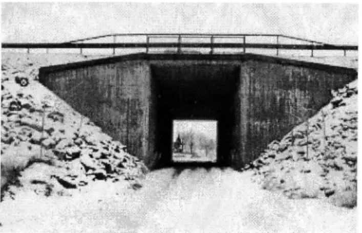
Standardized estimates of the cost of damage to
nature caused by emissions of the same pollutants were Figure 2 Position of the eastern tunnel portal at made on the basis of the environmental evaluation Trollebo in the Klevaberg forest.
factors used by the SNRA.
See Appendix for a description of the method.
3 Ecological impact
3.1 Large undisturbed areas
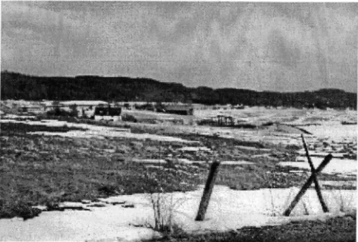
For their survival, many plant and animal species are dependent on large unfragmented areas of nature. Even though, in an international perspective, Sweden has relatively large areas of contiguous and comparatively undisturbed areas, these areas have suffered a drastic reduction over the past decades, not least because of the expansion of infrastructure (Sveriges Nationalatlas 1992). The remaining undisturbed areas are therefore rapidly increasing in value from the biological standpoint. The Natural Resources Act (Chapter 2 Section 2) states that "Large areas of land and water which have been affected only insignificantly or not at all by development schemes or by other encroachments into the environment shall asfar as possible be protectedfrom measures that can cause an evident change in the character of the area". The National Road Management Plan states that "... one criterion that is applied to large undisturbed areas is that they shall not be traversed by roads. Every new route through previously undisturbed areas should therefore be given special attention in this respect." (Nationell Vighallningsplan 1994-2003).
In cases where road construction through an area cannot be avoided, the road must be aligned in such a way, and such measures must be taken, that the biological values of the area are secured for the future. Regarding road construction in the region, the Road Management Plan states that it 1s "... important that road construction conflicts to the smallestpossible extent with wishes to conserve the areas for other interests." (Regional vaghallningsplan 1994-2003).
In order that they should have any real value, these adopted principles must come to practical expression in road planning. In this case road planning affects an area which must be considered to belong to the category of large undisturbed areas. It concerns the Klevaberg forest with its surroundings. The area 1s connected to large areas of forest to both the east (beyond Lake Stensjon) and the north (east of Huskvarna). To the west, the area of forest terminates at the fault scarp that borders the Rogberga Plain. This fault scarp is part of the pronounced fault which stretches from the Tenhult region to the north along the eastern side of Lake Vittern and up towards Ostergotland County.
14
Figure 3 The of -the
Rogberga Plain at Eket, Bogla. The new Highway 31 would cross over or through the fault scarp a little to the right of the centre of the photograph.
agricultural landscape
Between Bogla and Oggestorp the road would cut off a 3-4 kmportion of the contiguous area of forest between the scarp and Lake Stenson. The region would in this way lose another large contiguous area of forest of untouched character. For the Klevaberg district, the arrival of the road would mean that a heretofore "roadless" area would be cut in half. This would be to the detriment of plant and animal species which depend on large unfragmented and untouched areas of woodland for their continued existence. Certain animal populations in the cut-off area could in the worst case run the risk of being weakened or extinguished owing to their isolation from the surrounding areas of forest.
3.2 Landscape ecological connections
A landscape may be said to be made up of a mosaic of different landscape elements which have different ecological functions. Naturally, one and the same landscape element may have different functions for different groups of organisms. Apart from serving as habitats for a number of plants and animals, some of these elements are breeding areas for different groups of animals. Other landscape elements have the function of providing opportunities for dispersal between different parts of the landscape. Communication between isolated habitats can be made easier if there are stepping stones of appropriate ecological qualities between them. This
is one example of what may be called the ecological infrastructure of the landscape. Road and rail infrastructure often come into conflict with the ecological infrastructure. Roads and railways cut the ecological connections and relationships between the different parts of the landscape. Weakening of the ecological infrastructure 1s thus a phenomenon that has not only local but also regional consequences (Cuperus et al. 1993).
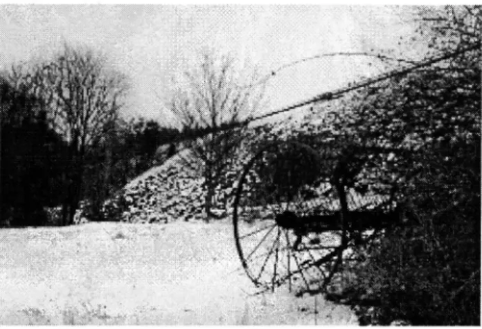
Rows ofbushes and other physicalfeatures which serve as guides for the movement of animals are examples of ecological infrastructure. The valley of Femtingaa brook.
Figure 4
Another landscape ecological effect of constructing a road through a landscape 1s that contiguous areas are cut up into smaller units; this 1s referred to as landscape fragmentation. From the ecological standpoint, fragmentation has two principal consequences, isolation and diminution of the habitat.
Isolation 1s primarily a consequence of the barrier effect of the road. Isolation may mean that populations are fragmented into smaller subpopulations, or that a population is denied contact with neighbouring populations. The possibility of exchanging genes may be critical for the ability of populations to survive in the long term. Gene exchange is dependent, inter alia, on dispersal corridors and other opportunities for the maintenance or re-establishment of contact between populations or subpopulations. That the significance of fragmentation for ecosystems is an important issue can be seen by the fact that it 1s referred to in a national commussion of enquiry into environmentally adjusted national accounts (SWEEA 1994).
Plant and animal populations need a certain area in order that they may be able to maintain all their vital functions. For animals which have a stationary way of life, it 1s chiefly the size and quality of the given habitat that 1s critical for the survival of the populations. If the
VTI MEDDELANDE 792 A
area of the habitat 1s reduced below a certain critical limit, there 1s a risk that the population will in time become extinct unless it can be "replenished" by immigration from other populations.
In contrast, other animals make use of large areas. One example is the otter (Lutra lutra) which often moves along watercourses over tens of kilometres. Other animals, during different stages of their life cycles, are dependent on biotopes of different characteristics in order that their survival may be secured. All these biotopes must be of acceptable quality. Some animals undertake seasonal migrations between habitats of different qualities. One example are amphibians which have different summer and winter habitats. For these migratory animals, it is essential that the opportunities for migration between these different habitats should be maintained.
All in all, migratory animals thus place high demands on the quality of several habitats which together occupy a large area.
In the study area, consideration of these landscape ecological relationships and dispersal biological conditions is particularly relevant in regard to the Klevaberg area, the fault scarp between Klevaberg and the Rogberga plain, and the valley of Femtingaa brook. Without a doubt, the road would mean that entirely new landscape elements would be created in a sensitive landscape. Irrespective of the route chosen, some area will be taken up, but it 1s hoped that by careful alignment valuable habitats can be largely avoided and habitat loss can in this way be minimized. For the landscape ecological relationships, however, the road constitutes a major encroachment. It is difficult to say to what extent fragmentation due to this road will affect the chances of survival of the affected plant and animal populations. It is quite certain, however, that even a single road such as this contributes to the fragmentation of the landscape which can in the long run jeopardize the biological diversity of the region. Together with other development and, not least, with the regional pollution load, the fragmentation effect of the road adds to the general load on the ecosystems concerned.
Apart from its given geological qualities, the fault scarp has a particularly high value in that it accommodates a mixed (broad-leaved and coniferous) forest which is largely uninterrupted along the entire scarp towards the north and up into Ostergotland County. This continuity is of great importance for the function of the area both as a habitat and as a dispersal corridor for many plant and animal species of distinct ecological requirements.
Figure 5
broad-leaved forest, is continuous from Tenhult up towards Odeshog in Ostergotland County. Photograph taken from Bogla towards the north.
Both the fault scarp down towards Rogberga plain and Klevaberg forest have great biological value in their continuity in both time and space. There is a lot of evidence that the mixed forest, with its high proportion of broad-leaved trees, has a long continuity in time. The physically difficult conditions of logging posed by the scarp which is in places very steep have naturally been greatly instrumental in ensuring that this forest has largely escaped the "rational" methods of modern forestry. In the same way, the structure of the stands and some signs of ancient forms of forestry (including woodland pasturage) in parts of the mixed forest in the Klevaberg area indicate that forestry here has been going on for a long time.
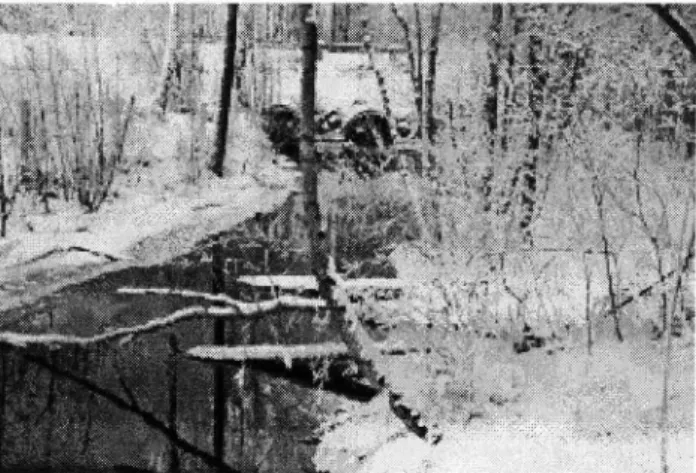
In the east of the area the proposed road crosses the valley of Femtingaa brook. The brook has been straightened and has in this way lost much of its natural values. But otters still move along the brook.
Figure 6 Femtingaa brook has been straightened. In time, the biological value of the broadleaved trees along the banks of the brook will increase.
16
The fault scarp, with its large element of
3.3 Local disturbance effects
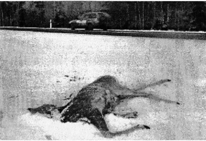
A road project also produces local disturbance effects in the form of wildlife accidents, changes in the local climate, pollution of vegetation, soil, groundwater and surface water, changes in hydrology, noise and light pollution, and disturbance through the presence of people and their activities. In the case of Highway 31 it may be warranted to refer to some of these effects, namely wildlife accidents, changes in the local climate, pollution of vegetation, and hydrology.
From the biological standpoint, wildlife fences should be erected only where they do more good than damage. The decisive issue ought to be what is worst for the game population, isolation or being killed by traffic. In practice, however, it 1s not biological considerations but traffic safety aspects that decide whether or not a section of road should be fenced.
The Klevaberg area with its surroundings is rich in game. Since moose and deer may walk long distances to get round a fence, extension of the fence a long distance beyond the game-rich forest areas is justified.
The area is rich in game. It is planned that the whole Bogla-Oggestorp section will be fenced. Figure 7
A road that is constructed through an area gives rise to changes in local climate, especially in forest regions. The local climate 1s often changed towards the drier, owing to the fact that the road opens a wind corridor in the otherwise closed forest, and because insolation increases. It 1s reasonable to assume that this effect may be reinforced by the heat that 1s often stored in summer in the road structure and the surfacing. In addition, traffic itself creates a certain amount of wind which probably further contributes to making the local climate drier. Mosses and lichens have no roots and, in practice, they have no means of regulating water content in their tissues. Mosses and lichens that live on the ground, stones and trees are therefore very sensitive to changes in local climate. It 1s probable that many colonies of
endangered species have been eradicated as a result of the local climate becoming drier, or because of this in combination with the air pollution load.
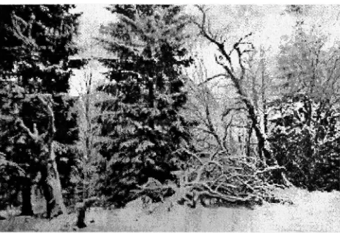
Mosses and lichens are in addition generally sensitive to air pollution, especially acidic and nitrogenous pollutants. Neither pollutant deposition nor changes in the local climate are limited to the area close to the road, i.e. a few tens of metres. Because of this, a road in a forest area can have a negative effect on the living conditions of moss and lichen vegetation in a corridor that extends a long way on either side of the road. It should in this connection be mentioned that the new Highway 31 in the Klevaberg area passes over ground which has in places been extensively clear felled. In these areas the forest ecosystem has already been seriously disturbed.
In the Klevaberg forest there are large areas which have been clear felled. This is the alignment of the road near Trollebo in the tunnel alternative. Figure 8
Hydrological changes as a result of road construction are a neglected problem. Both construction operations and ditching along the road may have unpredictable effects on hydrology far beyond the area nearest the road. Even a moderate lowering of the groundwater table may have pronounced consequences for vegetation. Especially in habitats characterized by fluctuations in groundwater level, such hydrological changes may have drastic effects on the function of the entire ecosystem. Such changes can obviously easily jeopardize the survival of animals and plants (inclusive of mosses, lichens and fungi) with special hydrological demands.
3.4 Key-habitats
Forest patches which contain or may be expected to contain species classified as threatened (endangered, vulnerable, care-demanding or rare) are denoted key-habitats (Nyckelbiotoper 1 skogen 1993, Biologisk mangfald 1 Sverige 1994). Key-habitats are of great significance for biological diversity. Some of the habitats
VTI MEDDELANDE 792 A
specially noted in the Nature Conservancy Decree nowadays enjoy special protection under the Nature Conservancy Act. These biotopes demand special consideration in road planning.
One of the results of the earlier inventories in conjunction with the Bogla-Oggestorp section of Highway 31 1s that a number of key-habitats have been identified in the study area. It must be noted that the vegetation inventories were mainly made in the spring and thus concentrated on the moss and lichen flora. Botanical (and zoological) inventories during the vegetation period may very well identify further key-habitats in the area.
Both the alternative with a tunnel and the one without would cross the biologically valuable forest area WNW of Kaveryd and may therefore jeopardize the survival of certain mosses and lichens that are sensitive to disturbance, and not just in the immediate vicinity of the road. Special attention must be paid to rocks facing east. Especially the alternative without a tunnel would also cause disturbance to the moss and lichen vegetation near the fault scarp. The existence of the highly disturbance sensitive Lobaria scrobiculata above Hulugarden could for instance be jeopardized.
Steep rockfaces often house a rich flora of mosses and lichens. Klevaberg forest to the west of Kaveryd.
Figure 9
The value of the area as a breeding site for the eagle owl (Bubo bubo) would also probably be affected by a road here.
3.5 Overall assessment
The area under study contains no nature reserves or areas which are at present classified as of national interest for nature conservancy. However, in judging the natural value of an area, such administrative classifications are only one of the bases of assessment. What is important is that the area should be considered as an entity when an overall assessment of its natural values is to be made. In such a perspective, we arrive at a picture that highlights the value of the area as a whole from the biological standpoint.
The following factors specially contribute to the natural value of this area:
Relatively diverse flora
The study area and its immediate surroundings house a number of plant species which indicate key-habitats, 1.¢. areas of high conservation value. This 1s particularly the case in relation to the lichen and moss flora where a number of threatened species have been noted. Some areas deserve special mention, namely the fault scarp between Klevaberg forest and Rogberga plain and certain areas of forest that resemble natural woodland, as well as rock outcrops facing east in the area between the scarp and Kaveryd.
Certain animal species in need of consideration or worthy of conservation
It may be mentioned here that curlew (Numenius arquata) nests in the Oggestorp area and that eagle owl nests, or at least has nested, in the forest area above the scarp. Otter is regularly seen in Lake Stenson and in Femtingaa brook.
Geological formations
The most important of these are the fault scarp and obvious traces of ice action at Ravabackarna. The spring fens adjoining Ravabackarna should also be mentioned.
Figui'e 10 gravel pits.
Rdvabackdrna dre partly lacerated by
18
Rocks
The presence of greenstone indicates favourable conditions for caleicolous plants.
Topography
The area as a whole exhibits great topographical variation. Special mention should be made of the pronounced fault scarp, the heavily undulating forest region above it and the marked variability of the landscape.
Temporal continuity of the natural landscape Continuity 1s specially seen in the vegetation of the fault scarp and in some forest areas to the east of the scarp which contain farm woods with clear traces of old time cultivation methods. Fallen trees, deadwood and other key elements (Nyckelb1otoper 1 skogen 1993) have great natural values.
Spatial continuity of the natural landscape
The mixed forest of the fault scarp, with its large portion of broad-leaved trees, 1s of great value due to its spatial continuity as it 1s connected to the broad-leaved forest on the banks of Lake Vittern. This continuity 1s also a feature of the contiguous forest area above the scarp which 1s to some extent connected to the forest districts to the north and east. The habitats of the valleys of the streams are also of long spatial extent.
The diversity, small-scale nature and old-fashioned character of the landscape
The whole area 1s characterized by the high degree of variation of the landscape forms and natural areas, and by the diversity of landscape elements and farming units. In places, the cultivated landscape has an old-fashioned and small-scale character, for instance in the Oggestorp valley.
The cultural landscape of the Femtingaa valley. The Riavabackarna hills are situated beyond the row of trees, along Femtingaa brook.
Figure 11
It is also likely that further botanical, zoological and limnological values will be found when the surveys carried out so far are extended.
4 Simulation of exhaust emissions
The results of simulations of exhaust emissions and the cost of damage to nature caused by these are set out in the appendix.
The simulations show that the difference between the tunnel and non-tunnel alternatives is insignificant as regards the estimated emission of HC, CO, NO, and CO, by traffic along the Lidhult-Oggestorp section. This applies to both the years 1993 and 2005. The standardized estimate of the cost of damage to nature caused by these exhaust emissions also points to an insignificant difference for these alternatives.
It should be noted that the cost of damage to nature is a rough estimate which is mainly based on the value
VTI MEDDELANDE 792 A
placed on national emissions by the Commission of Enquiry on Environmental Charges (Sw. Mil Gavgifts-utredningen). In most cases, these values are based on the cost of installing filtration equipment in large incineration plants. The values are not differentiated regionally but apply to rural conditions in the country as a whole. The cost of damage to nature obtained in this way is to be seen as a minimum cost. For instance, the estimates take no account of health effects. Nor are the costs relating to encroachment, barrier effects etc included.
5 Possibilities of monetary evaluation of environmental
encroachment
Investments in traffic installations are preceded by an assessment of the macroeconomic consequences, inclusive of environmental impact (Effektkatalog 1989, Environmental Impact Assessment for Roads 1995). The decision makers must make a judgment regarding environmental impacts of highly variable character and importance. This causes great difficulties since different types of environmental impact are expressed in different ways. Three ways may be distinguished: qualitative, quantitative and monetary. These stages represent an increasing degree of simplification of a complex reality. Many environmental effects can and should be described only in qualitative terms. In the decision process great efforts are however made towards quantification. By no means all variables are at all measurable. A cost-benefit analysis represents a further stage. In this, an endeavour is made to put a price on effects in order that a unified measure of the macroeconomic profitability of the investments may be arrived at. In practice, however, only some environmental effects are expressed in monetary terms; some essential environmental values do not lend themselves to this.
Biological diversity and undisturbed nature are typical examples of environmental values which, according to many people, can or should not be expressed in monetary terms - they must be regarded as priceless. This subject is undergoing intensive debate, not least abroad.
According to economic theory, it is only when a commodity becomes scarce that we are prepared to put a value on it. It is only then that the commodity concerned begins to play a part in economic considerations. In Sweden, we are still quite well provided with relatively undisturbed nature, and biological diversity is still quite great compared with many other countries. This is the reason why the man in the street has had no reason to put a value on these.
There are a number of methods which have been tried to provide an estimate of the value of biological diversity, as seen from a review published by the Swedish Environmental Protection Agency (Biologisk mangfald i Sverige 1994). One method is based on the willingness of the affected persons to pay for an increase in diversity, or for the prevention of its reduction. One evident drawback of such hypothetical valuations is that the willingness to pay as expressed by the interviewed persons is a poor reflection of their actual willingness to pay if they were presented with a real choice. Another method is based on the travel costs of the interviewed person to attractive areas of nature, which may give an overestimate since there are other commodities apart
20
from biological diversity which are involved. The same limitation applies to the method which determines the actual differences in the price of houses in different types of nature.
Yet other methods are based on the costs of prevention or positive action. The starting point here are the costs of preventing a reduction in diversity or of "re-establishing" it. Another hypothetical use of these costs 1s to replace the diversity which has been lost with some other similar commodity. If this is the case of constructing wetlands or trying to establish a potential natural woodland, it 1s naturally impossible to imagine that a biological diversity which represents the total diversity in the lost ecosystem can be re-established. Nor can the cost of establishment in any reasonable degree reflect the biological values of the ecosystem that has been lost.
Figure 12 What is the value of biological diversity? Old pastures with elements of biologically valuable old broad-leaved trees. Near the proposed road to the south ofKaveryd.
A number of studies have been made regarding the willingness to pay for saving individual species. These have at times been well known and acutely endangered species such as the wolf or the white backed woodpecker. Obviously, such studies where there are relatively high hypothetical values say nothing about the willingness to pay for saving less spectacular species such as spiders or mosses. Hypothetically, it would also be possible to try and add up people's willingness to pay for all the individual species in an area worthy of conservation. The sums arrived at in this way would probably be preposterously high. It would be more reasonable to try and estimate the willingness to pay for the biological diversity of the area as a whole.
One general problem in trying to put a value on biological diversity 1s that the man in the street has neither
knowledge of the species which are worthy of conservation, nor is he even aware of their existence in a given area. And if he were aware of the presence of these species, it is not at all certain that he would put either an emotional or an economic value on insignificant mosses, however endangered they might be. These species have therefore an insignificant "existence value" for the man in the street. Assessment of the conservation value of an area must therefore be left to the experts. It must however be borne in mind that not even these experts can have an overall view of all the expressions of the biological diversity that are worth conservation in a given area. The authorities therefore have great overriding responsibility for the conservation of the biological diversity in given areas and in the country as a whole.
Another point which must be stressed 1s that all the results of interview based studies regarding the value of natural areas, species or biological diversity are very situation specific; the questions are put in relation to a given situation under given, and often hypothetical, conditions. These results cannot therefore be applied to other situations where the geographical, natural and socioeconomic conditions may be entirely different. Each area 1s unique.
The economic and social conditions also change at a much faster rate than the ecological ones, if it 1s at all possible to compare these rates. Values, both the purely economic and the more emotional ones, in many cases change very rapidly. Reference will only be made to two clear examples -the extremely high but rapidly diminishing interest in seals due to the mortality among seals a few years ago, and the rapidly increasing interest in recent years in the natural values of woodland pastures. The values of today must not be taken to be truths that will persist for the foreseeable future. The decision makers have great responsibility in this context regarding the freedom of choice of future generations.
In time, many fallen trees gather an interesting flora of mosses and lichens and a rich fauna of invertebrates.
Figure 13
VTI MEDDELANDE 792 A
One conclusion that is drawn in the review mentioned above is that it appears "... more reliable to base values ofdiversity and other environmental aspects on the cost of avoiding or removing disturbances than on investigations ofpeople 's willingness to pay." (Biologisk mangfald 1 Sverige 1994). It may also be possible to apply to road planning the experiences gained regarding the appropriateness of environmental charges as a policy measure and to let the costs of introducing a more ecologically adapted road planning process be the criterion for construction.
More about the economic aspects of biological diversity can be read in an investigation by Jernelov & Kageson (1992). Biological diversity is also discussed from the standpoint of values in a newly published investigation regarding the development of environmentally adjusted national accounts (SWEEA 1994). The difficulties of putting a value on biological diversity are formulated there in the following words (p. 49): "The difficulties offinding valuesfor what has been lost or risks being lost are almost insurmountable. In the matter ofbiological diversity it is almost impossible to avoid difficult ethical issues. It is next to impossible to put a value on phenomena which, according to some researchers, may be a matter of life and death for mankind."
For a description of methods of calculating the costs of environmental encroachment, reference should be made to a recently published review of the literature by Ivehammar (1996).
All in all, the experiences gained from the different approaches to putting an economic value on biological qualities in the form of threatened species and areas of nature worthy of conservation show that the methods applied so far have a number of shortcomings that greatly limit their usefulness. So long as these qualities have an insignificant value in the eyes of the general public, economists cannot make an economic assessment of their value. One essential condition for a change in this situation 1s that these biological values should be known to the public. Such an enhancement of awareness would presumably demand extensive educational inputs.
So long as economic science lacks an adequate method for putting a well founded economic value on nature worthy of conservation or on threatened species, decision makers must rely on experts in natural sciences in assessing the conservation value. It is of particular importance that such an assessment is made from a holistic standpoint and takes a long view. In the long term, it 1s likely that macroeconomic research can develop usable methods which can complement the traditional environmental impact assessment with
monetary values. Pending such increased knowledge of the "true" costs of encroachment, caution must be exercised, so that road investments which run the risk of committing large-scale environmental encroachment
22
are either given a lower priority or subjected to such ecological adaptation that the expected damage may be considered acceptable in a long-term perspective.
6 Measures for ecological adaptation of roads
6.1 General policy
As regards the effects of infrastructure on surrounding nature, road planning so far has been largely characterised by an avoidance strategy. What this means is that an effort is made to avoid contiguous undisturbed areas of nature, sensitive regions and other areas which demand special consideration. Obviously, this strategy which is based on current legislation (Natural Resources Act) is of considerable relevance. In recent years, however, there has been increasing realization that this avoidance strategy must be augmented with greater consideration of nature even in areas other than those which are specially designated as fragile, worthy of conservation or similar. Increased consideration of landscape ecological relationships and an endeavour towards ecological adaptation of infrastructure, regardless of the type of nature, has therefore become something of a guiding light. The work carried on within the framework of collaboration between the Swedish National Road Administration and the Swedish National Rail Administration and which has recently produced a report (Seiler et al. 1996) is one expression of this new approach to infrastructure planning. It sets out different aspects of road and rail planning from an ecological standpoint.
The opportunities for ecological adaptation of roads are greatest at the stage of road alignment in the landscape. By judicious planning, the road can be given an alignment such that interference with the landscape is the least possible. When this possibility has been exhausted, an endeavour must be made to minimize the effects of encroachment and, by various measures, to bring about the greatest possible ecological adaptation of the road. In other countries, different types of measures have been taken, the aim of which 1s to maintain or re-establish the ecological connections in landscapes and habitats which have been fragmented by roads and railways.
VTI MEDDELANDE 792 A
Figure 14 Where the road is sited on a high embankment, its barrier effect is practically total. European Route E4 near Griinna.
6.2 Animal passages
The report referred to above gives an international overview of animal passages and other measures whose purpose is to facilitate the movements of animals in fragmented habitats and landscapes (Folkeson 1996). The following names have been suggested for animal passages of different kinds:
An animal passage is an installation built to enable wild animals to pass over or under a road or railway without coming in contact with crossing traffic.
An animal bridge 1s an installation built to provide the animals with a (grade separated) passage over a road or railway. An animal underpass is an installation built to enable animals to pass under a road or railway.
Animal bridges may be wildlife bridges or ecoducts'. The name ecoduct should be reserved for larger (1.e. wider, as seen by the animals passing) installations in which natural vegetation has been established.
Conventional road or rail tunnels on top of which the ground and vegetation have been retained intact can of course be used for animal passage even if they cannot
' This term is used also in Dutch. In German-speaking countries, the alternative terms (Griinbriicke, Landschaftsbriicke, Biobriicke or Okobriicke are used, depending on character.
be classified as animal bridges, since they were primarily built for the sake not of animals but of traffic (or to eliminate noise pollution in housing estates).
Animal underpasses are given a position, size and design adapted to the group of animals in question; they can be referred to as wildlife, amphibian or badger underpasses (tunnels). When a farm road or similar passes through an underbridge, it can be given a width such that it also serves as an animal underpass although it is not one by definition.
If a culvert for a stream under a road or railway is provided with appropriate fittings, animals that follow the banks of the stream may pass through the culvert without having to get into the water or to cross the road or railway.
If bridges are sized and designed so that the banks of the river can pass through uninterrupted, animals are enabled to pass under the bridge both in the water and on the banks, and flying.
In some places roads or railways are carried over very wide or deep valleys on viaducts. In general, all kinds of animals can very easily pass under such viaducts (Vejen og miljoet 1992).
Animal passages can therefore be systematised as follows:
Animal passage Animal bridge
- Wildlife bridge - Ecoduct
- (Passage above road or rail tunnels)
Animal underpass - Wildlife underpass - Badger tunnel/underpass - Amphibian tunnel etc
- (Passage through an underbridge)
(Passage under a bridge)
- (Passage under a bridge over a river) - (Passage under a viaduct)
(Passage through a culvert for a stream)
(The names in brackets refer to arrangements which are not animal passages by definition, but may serve as such.)
Generally speaking, the need for, and expected usefulness of, animal passages should be thoroughly investigated with the help of biological experts. The choice of the type of arrangement is for instance highly dependent on the group or groups of animals to be catered for. The location of the passage in the terrain 1s also very important. It is therefore important to locate
24
the animal trails etc prior to planning. The animal passage itself must be designed in view of the needs of the animals for protection and safety when they use it. Other important details are fencing, the shape of the entrances to the passage, the way the passage blends into the surrounding terrain and habitats, and the provision of appropriate structures which help the animals find the passage.
Ecoducts are provided with the long-term purpose of linking up fragmented habitats and landscape elements through colonization and in this way to secure gene exchange within and between otherwise isolated populations of a large number of animal species (Conrady et al. 1993). It is therefore a feature of ecoducts, apart from their size, that they are built to serve most animal groups. Stringent demands are made on siting, shape, design, surrounding arrangements and even maintenance. The principal rule should be that the entire installation and its individual components, as well as the surrounding arrangements and the structures leading up to the ecoduct, are given as attractive and confidence inspiring a design as possible. In the same way, every disturbing factor should be reduced as much as possible. The endeavour should be that the animals will regard the ecoduct as part of the habitat or at least as a functional link between habitats on each side of the
road.
I
For further information on different types of animal
passages and other arrangements for the movements of
animals, as well as experiences of the performance of
these arrangements, reference should be made to
Folkeson (1996).
6.3
Bridges over watercourses
Intersections between roads and running water are
typical points of conflict between the built and the
ecological infrastructure. Traditionally, where a road
passes over a brook or a stream, a culvert 1s provided.
From the biological point of view, a bridge is for many
reasons preferable to a culvert. If a bridge is provided
instead of a culvert, there are far greater opportunities
for ecological adaptation regarding e.g. the physical
configuration of the watercourse, the structure of the
bed of the stream and conditions relating to
microclimatic features such as light and temperature.
The bridge should be designed so that migration by both
aquatic animals and animals which move along the banks
under the bridge is secured. The banks and their
vegetation should therefore as far as possible be
preserved intact. The bridge or culvert should be
designed so that the flow rate and character of the water
resembles conditions upstream and downstream to the
greatest possible extent. It 1s a very important principle
VTI MEDDELANDE 792 A
that continuity along the watercourse and the banks should be maintained or recreated throughout the watercourse.
The banks under bridges should be retained so that otters and other animals can pass under the bridge by land. The new railway near Falkenberg. Figure 15
Even under bridges (and in culverts) of small span, there should be a strip of land at least 50 cm wide, covered with natural material (soil, gravel, stones) which provides passage for foxes, badgers, martens and other animals that do not like to get their feet wet. Reluctance to go into the water will otherwise force the animal to cross the road, with an evident risk of being run over. For further information regarding different means of ecologically adapting passages over water, reference should be made to Folkeson (1996).
It must be added here that roads with their traffic always cause considerable disruption of the ecological relationships in the surrounding landscape and nature. It 1s only in certain respects and only to a certain degree
VTI MEDDELANDE 792 A
that damage can be limited or alleviated by various measures in conjunction with road alignment and design. Naturally, all the intricate interplay in the undisturbed ecosystem cannot be maintained or recreated. It is against this background that different methods of ecologically adapting road schemes should be considered.
6.4 Treatment of runoff
Runoff water from roads carrying high volumes of traffic may contain such quantities of pollutants, mainly hydrocarbons and heavy metals, that some form of collection and treatment is required, especially in areas containing sensitive recipients or aquifers. In many places in Europe, e.g. in France, Germany and Denmark, highway runoff is routinely collected for treatment before it is released into the ground or recipients. Different types of retention and infiltration ponds may be mentioned among treatment methods. Artificial wetlands of different types have recently attracted increasing attention in conjunction with the treatment of runoff from roads.
If road runoff from a bridge is passed into the lake untreated, this constitutes a further pollution load on the water. An accident involving vehicles carrying hazardous goods could have disastrous consequences for the whole aquatic ecosystem involved.
The way how to treat the road runoff must be decided for every road individually in view of e.g. traffic volume and the natural environment concerned. For further information, reference is made to published overviews and recommendations (Folkeson 1994, Hvitved-Jacobsen et al. 1994, Larm 1994, Yt- och grund-vattenskydd 1995).
7 Recommendations regarding Highway 31
Against the background of the relatively limited knowledge base consisting of the existing environmental impact reports and the state-of-the-art of ecological adaptation referred to above, the following recommendations may be made regarding ecological adaptation of the new Highway 31 between Bogla and Oggestorp. It should be noted that, at the present stage of the investigation, these recommendations are preliminary and that they have not been considered in relation to any environmental impacts or consequences other than those which relate to ecological conditions.
7.1 The area as a whole
The value of the study area from the biological/ ecological standpoint consists not only of the presence of all the rare, threatened or care-demanding species which have been reported from a number of sites in the area. Nor can the presence of individual key-habitats alone give a true picture of the value of the area. The aggregate value of the area is considerably greater than the value of the sum ofits parts. What must be assessed is the area in its entirety, with all its geological formations, landscape elements, species, habitats and ecological relationships, and the interaction of the ecosystems with surrounding areas.
Looked at in this way, the area presents a picture of a highly variable landscape of old farmland and in places unbroken forest areas in which botanical, zoological and geological qualities, together with the high degree of variation in topography and land use, make up an area which, in the aggregate, has considerable environmental value.
7.2 The temporal aspect; changes in attitude In the large forest area above the fault scarp, there are a number of stands which, in regard to their uneven canopy density, different ages, standing dead trunks, old fallen trees, moss and lichen flora etc exhibit evident signs of long continuity. The biological value of such a forest must be judged in the light of the very rapidly shrinking areas of forest which have so far escaped the "rational" methods of modern forestry. Many endangered plant and animal species are entirely dependent of continuity in such forests for their survival. As Fasth and Bengtson (1993a and 1993b) point out in their inventories, the biological value of such forests, with their ancient features, increases as time goes by. Their value grows both in pace with the increasing rarity of forests with these qualities and because the increasingly senescent structures in the undisturbed forest provide
26
the conditions for colonization and the development of otherwise displaced species. Endangered and care-demanding species can find refuge here.
The cultural landscape at the fault scarp near
Figure 16
Another time-related aspect which 1s important in this context concerns attitudes to nature and her details. A look at attitudes a few decades ago will immediately reveal that views regarding what is "rare", "worthy of conservation", "endangered" etc are undergoing considerable change. What was previously considered "poor quality"" forest may today be found to give shelter to a number of threatened species. Just as little can we predict what biological qualities we may in future find to be associated with a forest that 1s at present considered to have some, but relatively limited, natural values. An expression of this diffidence regarding the future would be well in line with the declared endeavour of the Swedish National Road Administration that its activities "... must be adapted to a sustainable development" (Milsorapport 1992 1993).
Figure 17 The old broad-leaved trees of pastures accommodate a large number of mosses and lichens. Near the line of the road proposed to the south of Kaveryd.
7.3 Measures for the passage of animals In the national road management plan it is emphasized in relation to north Skane and the inland of Smaland (where the study area 1s situated) that "The large-scale migratory needs of wildlife should be catered for". (Nationell Vighallningsplan 1994-2003).
Without a doubt, the tunnel alternative would serve conservation interests in the large forest area above the fault scarp much better than the one without. The tunnel alternative would mean that interference with the scarp itself would be less and some fragile areas of nature near Hulugarden and Norra Uppegarden would be spared. A tunnel would also limit the barrier effect and isolation created by the road in the so far contiguous and relatively undisturbed forest area which stretches between the scarp and Lake Stensjon/Oggestorp.
An animal passage in the form of a viaduct or ecoduct in the area to the west of Kaveryd has been discussed as an alternative to a road tunnel. Whether in such a case an animal passage should be provided for the sake of moose and deer or whether it 1s more warranted in its role as a means of passage for other animals should be decided by zoological experts in view of the needs of the animal populations concerned. Experiences regarding planning should be obtained from e.g. a planned extended road bridge in Nyland (Utbyggnad av riksvag 7 till motortrafikled avsnittet Forsby-Lovisa
1994).
VTI MEDDELANDE 792 A
Figure 18 Underbridges on the new Highway 31 in the Klevaberg district should be sited and designed so that wild animals can also use them. The photograph shows an underbridge on Highway E4 at Griinna which is not at all adapted to animals.
Where underbridges for forestry roads etc are planned, provision should be made to widen these and to design them so that movement of wild animals through them is encouraged. Where the road passes over Road 943 (Huskvarna-Tenhult), passage facilities should be provided for wildlife.
Whether or not a tunnel 1s constructed, the route of the proposed road WNW of Kaveryd is unfavourable inasmuch as the part of the forest which has an ancient woodland character will be directly affected. There is not very much potential for damage limitation here, and it will be more a matter of aligning the road with care.
In order to minimize disturbance by people, cars should not be permitted to stop on the section of road between the fault scarp and Kaveryd.
74A Measures in conjunction with the bridge over Femtingaa brook
The design of the bridge over Femtingaa brook should be such that movements and dispersal of both terrestrial and aquatic animals are secured along the brook. This implies, inter alia, that the bridge must be built at such height above the water that sufficiently wide banks are retained on both sides, so that otters and other animals can pass under the bridge on dry land.
Figure 19 On their way along Femtingad brook, otters can hardly pass through this culvert but are forced up on the road. Femtingen.
7.5 Hydrological conditions
The impact of road drainage on hydrology should be carefully investigated so that changes in groundwater level or other hydrological conditions do not cause disturbance to habitats dependent on groundwater. It must be borne in mind that hydrology may be affected a long way from the road.
7.6 Treatment of road runoff
The volume of traffic on the road will not be so high that special treatment of the runoff from the road may be warranted. Runoff from bridges over watercourses should never be allowed to flow into the watercourse untreated, however. Appropriate arrangements should therefore be provided at the bridge over Femtingaa brook. In the same way, steps should be taken to prevent runoff from the road reaching wetlands and wetland elements in the area, for instance in the fault scarp (in the non-tunnel alternative). It should be possible to do this relatively easily by taking the surface water to a less sensitive area.
28
Figure 20 The constancy of climatic and chemical conditions around springs provides good living conditionsfor specialized moss species. Spring (old well) in the former meadow to the south ofKaveryd.
7.1 Measures in conjunction with road construction
Owing to shortage of time, the commussion could not include proposals regarding measures to be taken during road construction. Attention should however be paid to some general points.
e Watercourses should be affected as little as possible by construction activity. Beds and vegetation along the banks should be left undisturbed as far as possible.
e Work which affects watercourses should be done at a time of year when disturbance to aquatic organisms 1s minimized. The greatest possible care should be taken that watercourses are not made turbid.
e Blasting should be carried out at a time of year and in such a way that disturbance to the breeding of wildlife 1s avoided.
e Works traffic should be arranged so that as little undisturbed ground as possible 1s used.
7.8 Augmentation of the nature inventories Although in this case there 1s valuable inventory material available, most of this work was made over short periods during the time when trees were not in leaf, and it mainly concentrated on the moss and lichen flora. The inventories must be augmented with thorough inventories of vascular plants, fungi and fauna and with limnological investigations. The often good knowledge possessed by local nature conservancy organizations, hunters and people interested in nature must also be made use of.
1.9 Follow-up programme
The commussion includes no proposals for a monitoring or follow-up programme. All we want to do here 1s to point out that follow-up of the environmental impact of a road scheme 1s of great value as far as feedback of experience is concerned. Follow-up is a chapter in Swedish road planning that 1s seriously neglected; only
VTI MEDDELANDE 792 A
a few follow-up studies have been published so far. The lack of follow-up is something that is often commented on in an international EIA context (Road Transport Research 1994).
In this case a programme should therefore be drawn up for following up the impact of the road scheme and traffic on vegetation, fauna, limnological conditions and other natural environmental conditions. Regardless of the level of aspiration which the Swedish National Road Administration adopts for this follow-up programme, its arrangement must be preceded by careful planning in cooperation with biological/ecological experts. Special steps must be taken to ensure that accurate documentation 1s available regarding conditions prior to development, and this demands planning in very good time before construction begins. Planning should, inter alia, comprise the establishment of permanent plots for repeated monitoring.