Scientific Press International Limited
Water Resources Projects in Iraq, Irrigation
Mukhalad Abdullah1, Nadhir Al-Ansari2 and Jan Laue3Abstract
Along Tigris River reach inside Iraq, many large and small projects of irrigation were built. These projects depend on gravity flow or pumping. Starting from Jazeera project, then small projects downstream Fatah, where these feed by pumping. After Samarra scheme, the important Ishaqi project, then after Baghdad, the projects of Nahrawan, Middle-Tigris and Dalmaj. The most important branch from Tigris is Gharraf Canal which is not exploited yet, although plans were prepared decades ago. Downstream Kut Barrage, several projects are especially on the right side of Tigris. Finally, Shatt Al-Arab project which has a unique importance as it provides the solution for municipal need and save the orchards of dates in Basra.
Keywords: Jazeera Project, Ishaqi Project, Middle-Tigris Project, Gharraf, Shatt Al-Basra.
1 Private Engineer, Baghdad, Iraq.
2 Lulea University of Technology, Lulea 971 87, Sweden. 3 Lulea University of Technology, Lulea 971 87, Sweden.
Article Info: Received: October 20, 2019. Revised: November 11, 2019. Published online: December 6, 2019.
1. Introduction
In this paper, a review of Irrigation projects status along Tigris River was presented. Some of these projects were started centuries ago, as the example of Ishaqi, others are depending on pumping. After Samarra, all the projects built with drainage networks, where many discharge to Main Outfall Drain or to Tigris. Development stages covered many projects upstream Kut Barrage, but this does widely occur in the lower Tigris or in Gharraf area yet. However, Gharraf projects, Great Amarah project and Shatt Al-Arab project are an important pending projects to enhance socio-economic conditions, food security and environmental aspects.
2. Jazeera Irrigation Project
It is one of the most important strategic projects in Nineveh governorate; the project's land is located within areas with good rain and good soil and is suitable for the establishment of complementary irrigation projects to maximize the production of the winter season, mainly grain. There were initiatives of thinking about Jazeera project with studies of Mosul Dam, where it was planned where the reservoir would feed the surrounding land as well as other lands to the south. Development Board issued its resolution on July 7,1956, under which it commissioned the U.S. Kuljian Company to study the possibilities of land development around Mosul Dam reservoir, and a year later the company submitted a proposal to invest 1,037,000 dunams in three sectors north, east and south, named respectively North Jazeera, East Jazeera and South Jazeera.
The northern part is located northwest of Mosul and extends to Rabiaa and is fed through a pumping station on the right side of Mosul Dam Lake. The southern section is located south-west of Mosul city and draws its water from a structure within the dam and passes through a number of tunnels, the most important of which is the tunnel beneath Mount Sheikh Ibrahim, while the eastern part of the project irrigates the plains of Nineveh east of Tigris through the flow of water from the lake through a tunnel, and this section includes the lands irrigated by pumping at the areas at confluence of Great Zab River with Tigris River.
Nedeco Company subsequently prepared the project designs, project implementation were delayed as Mosul Dam project delayed where the implementation started at the beginning of 1985, when a Chinese company began implementing its first part, North Jazeera Irrigation Project.
Northern Jazeera irrigation project net area is estimated to be 240,000 dunams irrigated by sprinklers, which is in the form of a horizontal strip to irrigate the irrigation unit. Water is pumped into the project through a pumping station submerged in the Lake of Mosul Dam, and this station is unique as it is a capsule of concrete in an oval form within internal diameter of 60m and an internal height of 25m and thickness of the walls 2m, the station sucks the water by three openings. There were 12 pumping units distributed diagonally to raise water with design discharge of 34m3/s. Through two steel pipes, the water discharged to the stilling
service tunnel connecting the station to the lake bank and includes a cabin moved on railway to reach the capsule. The station was implemented by The Korean Company Hank Yung. Figure 1 showing views of the pumping station of North Jazeera irrigation project.
Figure 1: The main pumping station of North Jazeera Irrigation Project. Right: The image of the pumping station from the outside is stacked above
with stone to resist the buoyance force of the water. Left: A picture of the pumping station from the inside. (Source: [1]).
Water is pumped into the main canal from which many sub-canals are branching, all of which are lined with concrete. Within the project there are two other pumping stations, the first is the Tel Al-Hawa pumping station, which includes 5 pumping units with capacity of 6.3m3/s for the pumping unit, and the second is a pumping station with two pumping units with capacity of 6.3m3/s for each unit. These two
pumping stations were equipped with Technopormexport brand pumps.
The project consists of two stages; the first was implemented for irrigation by sprinklers and using sprinklers of the brand (Valley), the area is 157 thousand dunams, and the second within area of 83 thousand dunams irrigated by gravity initially, started to equipped with sprinklers of the brand (Bauer). The sprinklers were vandalized and looted following the security events of 2014. The project does not include field drains, but rather drains water through the natural streams of the area. The project's system gates are Avio and Avis self-propelled type.
The project and pumping stations were mainly vandalized and looted after the events of 2014, and rehabilitation work continues with the support of international organizations.
Within Ease Jazeera project, Salamiyah Irrigation project which is a small project with net area of 7,000 dunams located along Tigris River in Hamdaniya district near Nimrod ruins. The project irrigated by a pumping station that draws water from Tigris River and includes 5 metric pumping units and 5 half-metric pumping units. Project's land is watered by a 12.3km main canal and a 7km branch canal, and the project does not include drains, as the land naturally drains into Tigris River. The project area and pumping station were vandalized after the events of 2014, and the project and the station were reconstructed by humanitarian organizations.
East Jazeera project also includes Zab Irrigation project, which feeds from a pumping station on Great Zab River, where the station has six metric pumping units. The station is located at the village of Abzach and raises the water to a main canal that lasts 12.7km from which two branch canals, 6 and 9km long, branch. The irrigation system in the project is the pivot and horizontal sprinklers, where the project was started in 1993 and stopped, the resumed in 2005. Also, the sprinklers do not cover the entire area of the project, which amounts to 14,000 dunams, and the project does not include field drains. The pumping station for this project was also vandalized following the security events of 2014 and was rehabilitated by NGOs.
The part of East Jazeera which feeds directly from Mosul Dam Lake, which is the largest part with net area of 215,000 dunams, was started in 2012. Works were hold due to the events of 2014 as well as the national financial crisis. The 800,000 dunams South Jazeera project is still a future project [2, 3, 4, 5].
3. Small Irrigation projects in Upper Tigris
Several projects on Tigris River are along, from the south of Fas to the north of Baghdad, which are small projects, the projects generally in the form of a pumping station built on Tigris that feeds a main canal watering the lands near the river, sectors of these projects were studied for the first time by the so-called Naifa Irrigation Project, where Engineers Dr. Ahmed Sousse and Vahi Sevian in 1971 submitted the planning report of the project to the Supreme Agricultural Board and was aimed at studying the land to the left Tigris River in the governorates of Samarra and Tikrit. What was diagnosed in the first studies is the presence of gypsum in the soils, which necessitates the lining Canals to prevent collapsing. Some projects were subsequently implemented, which included in the studies and other projects as follows:
1. Alam Irrigation Project: The project covers the land located west of Alam city and adjacent to Tigris River and bordered to the south by the Tikrit-Kirkuk road, the net area of the project is 18,000 dunams, the project has been designed and studied by the general establishment of studies and designs and was implemented by the Turkish company Kaska and
commissioned in 1985. The project is fed from Alam pumping station on Tigris River, which has a discharge of 3m3/s. The water is raised to a 16.85km concrete main canal, from which concrete flumes are branching. There are no field drains, but rather natural streams st drain water into the Gulf and Al-Aly valley which flows into Tigris River, the other name of the project is Gulf and Al-Aaly.
2. Albu-Ajil Project: An extension of the land of the Alam project to the south of Tikrit-Kirkuk road. The project covers land with net area of 6,000 dunams. Water is pumped into the project through the Albu-Ajil pumping station on Tigris River, which includes a metric pumping unit and four half-metric pumping units.
3. A'wja Project: The project's land is located east of A'wja area in the land adjacent to the right of Tigris River. The project was implemented in 1983 to cover a net area of 6,500 dunams, which is watered from Tigris River by a pumping station of 2.5m3/s discharge capacity.
4. Owainat Project: The land of Owainat is located to the south of the city of Awaja, the right of Tigris River, and feeds from a pumping station with 4 half-metric pumping units to cover an area of 10,000 dunams.
5. Tigris Project: The land of project is located to the east of Tigris district and right to Tigris River within area of 11.5 thousand dunams, the project was implemented in 1984. It is fed from a pumping station on Tigris River with 6 pumping units with capacity of 1.15m3/s.
6. Dur project: The project land is located in Dur district and has a net area of 8000 dunams. The project is fed by a pumping station with discharge of 1.5m3/s.
7. Rasasi Project: The project's land is located east of Samarra, where the project was completed through the revival of the old Rasasi River and part of the old Nahrawan stream. The project is fed by gravity from Tigris River through head regulator which intersects with Samarra-Tikrit highway; the regulator has two openings and a discharge of 18 m3/s. It was completed in 1996. The main canal, which has been revived, is 34 km long and is planned to irrigate an area of 120,000 dunams, the current area being less. The project was completed within the current phase in 2001. Figure 35 shows a plan for Rasasi Irrigation Project.
8. Duloiya Project: it is located near the confluence of Adhaim and Tigris Rivers within the Duloiya area, water is pumped into the project, which is covered by a network of earth canals through a pumping station on Tigris River which includes 3 metric pumping units to meet the needs of the 25,000 dunams project.
9. Nai Project: A reclaimed project, where the land of the project is located to the left of Tigris River, the project feed from a pumping station on Tigris River located 8km downstream from the confluence of Adhaim and Tigris Rivers, pumping station discharge is 9m3/s. The net area of the project is 28,000 dunams. The project includes a 20.6km main canal and two boosting
pumping stations are located within the canal's path to raise water. The project drains its lands to Tigris River through drainage network. The project was designed and implemented by the Land Reclamation Establishment, which was started in 1976 and completed in 1983. The project is currently neglected and deteriorated for several reasons [2, 3, 4, 6].
Finally, it is worth to mention that small projects in upper Tigris generally suffered from an unstable situation and pumping stations were sabotaged, and the instability of the region after 2003 has contributed to an impact on these projects.
4. Ishaqi Irrigation Project
Ishaqi project was named after the ancient Ishaqi Canal, a canal which has existed since ancient times and extends from Tikrit to the depression of Agarkof, this canal has been deteriorated for a period of time, and then with the prosperity of the city of Samarra, the upper part of it was revived during the reign of the Abbasid caliph Al-Mutassim. The name of the canal was attributed to the Leader of the police of Al-Mutassim, Ishaq bin Ibrahim. The project returned under spotlights again by the proposals of British consultants in the first half of the 20th century, where the thought was to revive the streams in the areas of the right of Tigris River between Baghdad and Samarra. After the construction of Samarra Barrage, Development Board for the first time started studying the project. Later, Bennie & Partners completing studies and contracts design from (1) to (8) and in 1966 the Spanish company (Spanco) completed the contracts from (9) to (15). Ishaqi project extends from Ishaqi area to Kadhimiyah district, supplies mainly water from Samarra barrage through four concrete openings with dimensions 2.5m×3.5m extending in the form of tunnels of length of 391m, then discharge into an open canal which is the main canal of the project, canal discharge is 80m3/s, this canal is 30km long. At the 30km distance, the main canal is divided into two branches east and west branches, from which the boundaries of the project into two main sectors, east and west, the main road of Baghdad-Mosul is almost the separation between the two sectors. The eastern canal extends to the left of the main canal, crossing the Baghdad-Mosul road and runs parallel to Tigris River up to 80km, the maximum discharge is 38m3/s, and canal is lined with concrete. The western canal begins at the branching location of the main canal, continued downstream, with maximum discharge of 42m3/s, and a distance of 61km. This canal was lined with rubber layer
due to gypsum content of the soil; this was quickly damaged and replaced with concrete. The western canal is fed through siphons which pass down Tharthar-Tigris canal the lands north of Kadhimiyah district.
The net area of the project is 321,000 dunams with 66.4 thousand dunams of orchards, and in addition to the main canals there are 42 branch canals with total length of 665km, and 1,642 distributary canals with total length of 3,620km. The irrigation system is paralleled with two main drains, the 60-km-long Eastern drain and discharge of 6.35m3/s, and the Western drain which is 56km long and 6.2m3/s
discharge, the two drains made a confluence and starting point of Main Outfall Drain . In addition to the main drains, there are 27 branch drains, a total length of 971km, and 1,591 collector drains, a total length of 2,524km. For the right side of Tharthar-Tigris Canal, its territory is draining through the Sabaa Al-Bour, which flows into the MOD.
The project comprises several pumping stations, 13 pumping stations, 5 for irrigation and 8 for drainage, as shown in Table 1 below.
Table 1: Pumping stations in Ishaqi project. (Source: [4]). Description No. of pumping units and capacities Type Station Name
Draining water from the Eastern drain and Western drain before connection with MOD. Pumping drainage water to Tigris River, where station discharge is 12.5m3/s. After connecting the project to
MOD, the station's role was reduced to only the emergency .
4 units, discharge 3.14m3/s
each. Drainage
Tarmiyah Drainage (1)
Pumping drainage water from TD 18 to Western Drain..
4 units, discharge 1.16m3/s each. Drainage
Taji Drainage (2)
Pumping drainage water from WD 8 to Eastern Drain. .
2 metric units, one half-metric unit. Drainage
Drainage WD8
Pumping drainage water from ED33 to Western Drain..
3 metric units.. Drainage
Ishaqi Drainage (3)
Pumping drainage water from CD6 to Western Drain.. 3 metric units. Drainage Tharthar-Tigris canal/Sabaa Al-bour drainage
Pumping drainage water from EDN to Eastern Drain.
6 metric units. Drainage
Ishaqi Drainage
Pumping drainage water from D15 to Eastern Drain.
3 half-metric unit. Drainage
Drainage D15
Pumping drainage water from GD2 to Eastern Drain.
3 metric units. Drainage
Drainage GD2
Supporting station to feed Eastern Ishaqi Canal form Tigris.
4 metric units. Irrigation
Abayachi
Supporting station to feed Eastern Ishaqi Canal form Tigris.
3 metric units. Irrigation
Irfaiaa
Supporting station to feed Western Ishaqi Canal form Tharthar-Tigris canal. 4 metric units.
Irrigation Western Ishaqi irrigation
Pumping water from Eastern Ishaqi canal to EN-34 .
2 half- metric units. One unit of
discharge 0.125m3/s Irrigation
34 Eastern Ishaqi irrigation
Supporting station to Irrigate lands of Taji and Sabaa Al-Bour from
Tharthar-Tigris canal 3 metric units.
Irrigation Akshashi
Project implementation has been started since the late 1960s and began at an accelerating progress in the mid-1970s, the main canal opened in the summer of 1979, and the reclamation works continued until 1994.
The project suffers from several problems, the most important of which is the need for comprehensive maintenance works where it was the scene of various security events after 2003, in addition to the lack of sufficient quantities in the tail, where several pumping stations from Tigris River and from Tharthar-Tigris canal were implemented to confront the lack of water. The location of the project and the human density within the project's territory require a comprehensive rehabilitation process [2, 3, 7, 4 ,8].
5. Nahrawan Irrigation Project
The land of Nahrawan project is located within the area of the confluence of Diyala and Tigris Rivers, where project's net area is 161.6 thousand dunams is irrigated by pumping from the left of Diyala River upstream the confluence of Tigris River and from the left of Tigris River downstream Diyala River.
The project was studied by Development Board for the first time within Diyala-Left Kut projects, and was studied by the consultant Bennie and Partners, who submitted the report in 1956 and the consultant Sir M. McDonald, who submitted their report in 1959. The project has been under way since the 1970s. The project includes the following parts:
5.1 Mada'in Irrigation Project
The project has an area of 51.6 thousand dunams and irrigates from Diyala River and is fed by 3 pumping stations, which are:
a. Nahrawan pumping station has 4 pumping units with capacity of 2.07m3/s, and 7 metric pumping units
b. New Qargholia pumping station has 6 metric pumping units. c. Old Qargholia pumping station has 4 metric pumping units.
Because of the fact that pumping stations are located in Diyala River and its proximity to the waste discharge of Baghdad's sewers, the pumping of sewage water affects the quality of water. The project canals are not lined and the network of the drainage is connected to Wehda project.
5.2 Wehda Project
The project area is 42,000 dunams implemented between 1972 and 1980, where most of the project's canals are lined with concrete. The project is fed by the main Wehda pumping station that lifts water from Tigris River and includes 4 discharge units of 4.86m3/s discharge per each, while the total discharge is 13.5m3/s, within the station there are also 8 metric pumping units. There are also two booster stations on branch canals in the project:
4.81m3/s and 5 metric pumping units.
b. The first booster is comprised of 3 pumping units, capacity of each is 2.8m3/s and 5 metric pumping units.
Wehda and Mada'in projects share the drainage to Al-Lej main drain in the south of the project and from there to Salman Pak pumping station, which drains water to Tigris River, the capacity of the station is 5 m3/s and includes 5 pumping units with capacity of 1.7 m3/s.
There are also Irrigated land from Diyala and Tigris rivers by private pumps with total discharge of 20.42m3/s [2, 3, 4, 7, 9].
6. Middle-Tigris Project
One of the most important projects that extends right and left of Tigris River between Baghdad and Kut, it includes important cities, most notably Suwaira. The project was first studied in Diyala-Left Kut projects under Development Board by Sir. M. MacDonald, study had been submitted in 1959. The project was studied again by Swiss consultants and submitted their report in 1983, and then the Iraqi side re-studied the project, the last of which was a study submitted by the National Center for Studies and Designs in 2008.
The total area of the project is 1.66 million dunams, where some fully or in partially medium and small projects were developed inside the command area, namely, Hafriyah project, jut farm, state farm, Kusaiba, Shuhaimiyah and Radhwan Farm, the total area of 440,555 dunams. Excluding city areas and areas for urban development, Tigris River, transportation routes and current and future infrastructure, the remaining area to be developed is 792,323 dunams as net area. The development of the project in its integrated form includes two alternatives:
1. Irrigation through the construction of the proposed Suwaira Barrage through which the construction of two right and left canals to irrigate the project's land in addition to the boosters within the project.
2. Irrigation by pumping includes the installation of pumps on right and left of the river for watering the land. The latest study by the National Center for Studies and Designs preferred this option after conducting economic analysis and calculations of the cost of construction and operation.
In addition to future areas, the areas currently invested from the main project include the following projects.
6.1 Hafriyah project
Also called Suwaira project, the project is located on the left of Tigris River in Suwaira district, it has a net area of 133.6 thousand dunams. The project is irrigated by pumping from three main stations that feed the project, which are:
a. Khachiah First station: it is the largest station, includes 6 pumping units of capacity 5.14m3/s, the total discharge of 25.7m3/s. The station raises the
water to the 27.35km lined canal. On the canal's route there are some booster stations, the first booster is Khaciha second station at the13.5km, the second is Khachia third station at the 25.8km.
b. Zugaitiya pumping station: Water is pumped into Zugaitiya and Douhan Canals, the station has 4 pumping units of 3m3/s capacity, and 6 metric pumping units. Zugaitiya Canal is a 16.5km-long earth canal with discharge of 4.75m3/s. On the route of the canal, at a distance of 12.5 kilometers, there is a booster with 3 quarter-metric pumping units to raise water. Douhan Canal is also earth canal, 12.5km long and discharge capacity is 3.45m3/s, at the end of the canal there is a booster, which includes two metric pumping units and 3 quarter-metric pumping units.
c. Rubaidha pumping station: it is the last station to feed the 3.65 km long canal of discharge 4.8m3/s. The station comprises 4 pumping units, each of which is 2m3/s, seven metric pumping units and a half-metric pumping unit. In addition to what had been mentioned, the project includes branch and secondary canals counts 15 and a total length of 123km, 92 distributary canals with a total length of 166 km, 796 water courses with a total length of 812km. The Drainage network consists of the following:
a. 3709 field drains with and a total length of 15,439km. b. 780 collector drains with a total length of 862km. c. 87 Secondary and branch drain of a total length 269km. d. 34 km main drain, also called Hallata drain.
e. Hafriah Southern Drainage station includes 4 pumping units with discharge of 0.7 m3/s per unit and a metric pumping unit. Station capacity 2m3/s.
f. Hallata main drainage station, which pumps water into Tigris River, comprises 4 pumping units with discharge of 2.2m3/s per unit and the total discharge is 6.51m3/s.
The project was implemented between 1974 and 1990. Canals, especially the unlined, suffer from the change in the shape of the section, in addition to the interruptions and lack of maintenance of pumping stations, especially the boosters. 6.2 Kusaiba Project
Kusaiba project is located south of Suwaira and its land is located between Tigris River and MOD. The net area of the project is 45.8 thousand dunams. The land is irrigated by pumping through a pumping station on Tigris River, which includes 7 pumping units with discharge of 2m3/s per unit and a total discharge of the station is 12.6m3/s. The station lifts the water to a 10km lined main canal, from which the branch and the distributary canals with total length of 143km are branching. Drainage network consists of the following:
a. Field drains, a total length of 1720km.
c. Secondary and branch drains of a total length 96km. d. 19km main drain.
e. A Drainage station on the main drain route includes 5 pumping units with different discharges. Station capacity is 2.86m3/s.
f. Main drainage station, which pumps water into MOD, the total discharge is 4.3m3/s.
The project was implemented from 1973 to 1984. 6.3 Shuhaimia Project
The project is located to the south of the Kusaiba project, where it covers a net area of 167,000 dunams. The project is irrigated by pumping from Tigris River through a main pumping station with 4 pumping units, each 4.3m3/s, and the total discharge is 13m3/s. The station lifts the water to a main lined canal of 20 km long, as well a network of branch canals of total length 143km, and a total of 336km of distributary canals. This network is paralleled with a drainage network consisting of the following parts:
a. Collector drains with a total length of 317km.
b. Secondary and branch drains of a total length 127km. c. 13.23km main drain.
d. Main drainage station, which pumps water into MOD, the total discharge is 3.2m3/s.
e. The project was implemented from 1973 to 1984. 6.4 Dabouni Project
It is also called Jut Farm, where its purpose was to invest its land to grow jute and linen. The project is located near the city of Daboni, the left of Tigris River, with net area of 54,000 dunams. The project feeds from Tigris River through a main pumping station with 6 3.2m3/s pumping units and the total discharge of 16m3/s. The station lifts the water to a 22.5km lined main canal. Another booster pump which is also located on the main canal route, it has 4 metric pumping units. The project is fully reclaimed and covered by branch and distributary canals of total length of 78.8km and Flumes of total length of 371.7km. The Drainage network consists of the following:
a. Field drains with a total length of 1760km. b. Collector drains with a total length of 338km. c. Branch drains of a total length 199.7km. d. Main drain, the length is 33.85km.
e. Main drainage station, which pumps water into Shweicha Lake, the total discharge is 5m3/s, where it has 10 metric units.
6.5 State Farm
One of the projects linked to Badra-Jassan project, which will be detailed later. State farm is located south of the Dabouni project, where they are separated by the Dabuni-Badra road; the project has a net area of 25,000 dunams. The project feeds from the main canal of the Badra-Jasan project at the distance of 10km, where the water is supplied by the 3m3/s state farm canal, irrigation network has Flumes with total length of 23.85km. Project is draining to Shweicha Lake through main drainage pumping station, it includes 4 metric pumping units.
6.6 Radhwan Farm
Also called Radhwan Forest, the farm is located west of the city of Numaniyah and is irrigated through pumping station on the right of Tigris River; station has 5 metric pumping units [4, 10, 6].
7. Badra-Jassan project
Badra and Jassan area is well known over time with palm orchards of rare varieties. Badra Valley, which originates from the Iranian side, had suffered since 1930s from water scarcity, which has begun to worsen in this area, especially after the construction of a dam on Kinjan Jam Valley. Iranian side has diverted the course of Badra Valley itself. The basis for the division of water between the two countries is 3/5 for Iraq versus 2/5 for Iran according to the agreement between the two countries, which the Iranian side has not complied with. The area has been home to centuries-old palm orchards, also the people were displaced, and water for the city was supplied by potable tankers. In 1953, General Irrigation Directorate carried out 18 regulators on Badra Valley to cope with the drought, which did not work. Subsequently, in 1961, Planning Board entrusted Sir M. McDonald to study the provision of alternatives to the area of Badra and Mandalay. The company submitted its report, which included the current alternative, in 1969. The project aims to irrigate:
1. Area of 4,075 dunams of orchards with drinking water in Zurbatiya. 2. Area of 11,075 dunams of orchards with drinking water in Badra.
3. Area of 52,000 dunams is being developed for seasonal agriculture with drinking needs in Jassan.
Because of the circumstances of the Iraq-Iran war, the main route and parts of Jassan lands were implemented. The main path, which forms the backbone of the project, includes the following parts:
1. Pumping station No. 1 on Tigris River, it raises water to the main canal. The station has 5 pumping units, each 3.4m3/s. The total discharge of the station
is 12.5 m3/s.
2. Main canal heading towards Badra is 65.5km long and the canal is partially lined. At the distance of 10km, a canal is branched from the main canal to the state farm. The canal passes through its route through two siphons; first
at the intersection of Shweicha Lake and the second at the intersection with Tarsakh Valley.
3. Pumping station number (2) on the canal path. The station has 4 units of 3.4m3/s discharge, and 4 metric pumping units.
4. Pumping station No. 3 on the canal track at the intersection of the canal with Tarsakh Valley, upstream the siphon structure. The station has 4 units of 3.4m3/s discharge, and 4 metric pumping units.
5. Pumping station No. 4 is located at the end of the canal and feeds two routes, one to Jaasan and the other to Badra. The station has 4 units of 3.4m3/s discharge, and 4 metric pumping units .
6. The canal of Jassan, a lined canal of length 13.2km and discharge 13.2m3/s.
The canal irrigates an area of land of about 25,000 dunams and supplies drinking water to Jassan.
7. Badra Pipe route, running from pumping station no. 4 and 17.5km long to pump station no. 5.
8. Pumping station No. 5, which raises water through two pipeline routes, one to Badra and the second to Zurbatiya to supply the requirements of irrigating orchards and drinking. The station has 6 pumping units, each with discharge of 0.35m3/s [6, 11, 3, 4].
8. Dalmaj Irrigation Project
Dalmaj project extends between the cities of Numaniyah and Kut, bordered to the north by Tigris River and to the south by Dalmaj Lake. The project was first studied by Development Board from 1956 to 1959, where the study was carried out by Sir M. MacDonald. The designs and contract documents were prepared between 1960 and 1963 and one of the requirements for the operation of the project was to raise the operating level of Kut Barrage to 18.1m a.s.l. The 237,000 dunams area of the project consists of three main canals connected to a network of branch and distributary canals paralleled by 3 drainage networks for each major canal. The main canals from the upstream to the downstream are Huwar Canal, Hussainia Canal and Mazak Canal. These canals are working on gravity feed except for Huwar Canal, which is feed by pumping; knowing that the proposed Suwaira Barrage will provide the gravity feed for this canal. After the water scarcity and the decision to reduce the operating level of the Kut Barrage to 16m a.s.l., this led to the cancellation of the Kut Barrage rising role, which was completed in 1967, this consequence the adoption of the project canals on pumping during the periods low level flow. "Figure 2" shows a map of Dalmaj Irrigation project. The main canals of the project have the following details:
1. Huwar Canal: A 24.9km unlined canal. On the head of the canal is a pumping station with 3 pumping units of 4 m3/s discharge, 5 pumping units with 3 m3/s discharge, and the total discharge is 20m3/s.
2. Hussainia Canal: A 30km unlined canal, water is drawn from Tigris River through a 3 openings head regulator with maximum discharge of 13.5m3/s
and a normal discharge of 8.34m3/s. Also, a pumping station with 12 metric
pumping units was installed near the head of the canal.
3. Mazak Canal: A 22km unlined canal, water is drawn from Tigris River through a two-open head regulator with maximum discharge of 9m3/s, and a normal discharge of 7m3/s. And, a pumping station with eight metric pumping units was installed on the head of the canal.
The Drainage network in the project, which drains to Great Gharraf Drain in the south of the project, consists of the following:
1. 90 km main drains. 2. 392 km branch drains. 3. 1238 km collector drains. 4. 8,000 km field drains.
The project was reclaimed from 1974 to 1984 by a Pakistani company, where the integrated reclamation works included an area of 153,338 dunams [4, 7, 6, 12].
9. Gharraf Canal projects
Gharraf Canal is the largest and longest branching stream of Tigris River, with length of 178km and a maximum discharge of 500m3/s. On this canals are several cities, including Muwaffaqiya, Al-Hay, Fajir, Qal'at Sukkar, Rifai and Al-Shatra. Water is provided for irrigation and drinking for these cities ant the territories, as well as providing drinking water through Basra water canal to meet the drinking needs of the cities of Nasiriya, Basra and Suq Al-Shoyukh. The development of Gharraf area has been the interest of all the consultants who worked on the irrigation development in Iraq, the first of which was William Willcocks, who proposed the establishment of Kut Barrage. Later under the Development Board, The American Company TAMS submitted a study on the improvement of irrigation in the region in 1952, followed by CUTHA to study the project and then the company Sir M. McDonald studied the projects of Gharraf, where the projects were divided into two main parts, the lands to the left and named East Gharraf and the lands to the right and named West Gharraf, the company submitted its report in 1968. Then Gersar, a French company, presented a study about the project in 1983, which included the project's drains, which was not presented by M. McDonald's. Later, Swiss consultants have also presented studies on land development downstream of Badaa regulator. Figure 3 shows East Gharraf project and its development plan.
Figure 3: East Gharraf project and its development plan. (Source:[13]). The net area for the project's project is 384,000 dunams for West Gharraf and 475,000 dunams for East Gharraf, development has only made in some sectors in Magheshi and Dawaya, in addition to the construction of regulators, drains and some pumping stations. Dozens of earth canals continuing to supply water from both sides to the non-reclaimed lands of Gharraf area. Gharraf Canal includes the following projects:
9.1 Gharraf Canal Regulators
On the main canal reach; according to the study submitted by TAMS company in 1952, Polensky and Zöllner form Germany started implementing four regulators, in addition to the construction of dykes on both sides length of 168km, works completed in 1966, and the details of the works as follows :
a. Regulator No. 1, near Al-Hay city, it has 5 openings and 250m3/s is the normal discharge, the maximum discharge is 500m3/s, the regulator includes a navigational lock.
b. Regulator No. 2, near Fajir city, it has 4 openings and 200m3/s is the normal discharge, the maximum discharge is 300m3/s, the regulator includes a navigational lock.
the normal discharge, the maximum discharge is 300m3/s, the regulator
includes a navigational lock.
d. Regulator No. 4, downstream of Rifai city, it has 4 openings and 250m3/s is the normal discharge, the maximum discharge is 300m3/s, the regulator includes a navigational lock.
9.2 Regulators of Badaa and Al-Shatra
Two regulators existing at the end of Gharraf Canal, they were created in 1929 from bricks, their details are as follows:
a. Badaa Regulator, which includes 6 openings, 3 of which are of dimensions 2.5mx5.5m and 3 openings are of dimensions 3.5mx5.5m, normal discharge of the regulator is 25m3/s.
b. Al-Shatra Regulator: It is the head regulator of Al-Shatra Canal, it includes 3 openings of dimensions 2.7m×3m and opening of dimensions 3m×3.5m, normal discharge is 15m3/s.
9.3 Magheshi Project
Part of the West Gharraf Project, the project is located in Fajir area where its water is derived from Regulator No. 3. The project was carried out in the 1970s and consists of an irrigation network fed by a 17.7km main canal of discharge 15m3/s. 9.4 Dawaya project
Dawaiya project is located in the downstream of Gharraf, where it includes earth canals, lands were partially reclaimed. The net area of the project is 135,000 dunams, mostly earth canals, fed mainly by Dawaya canal, which is branched from the upstream of Badaa Regulator. The project was implemented in 1970. Hutaman sector was carried out with and area of 23,000dunam, as well as Al-Shatra farm, which is area 16,000 dunams, these two sectors are parts of Dawaya project. The project covered by 112km of collector drains, 85km of branch drains and a 19km main drain which discharging to East Gharraf Drain.
9.5 East Gharraf Drain
The land of Gharraf is surrounded by two main drains, to the east, East Gharraf Drain, and to the west, Great Gharraf Drain and West Gharraf Drain. The 172km East Gharraf Drain extends form Dujailah project and connected to MOD, its' discharge is 26m3/s. The study and designs of the drain were completed by the French company Gersar in 1986 and work was initiated in the 1990s, where the main pumping station was completed in 1998 and excavations were carried out up to the distance of 65km in 2002. The pumping station was subjected to military sabotage during the occupation of Iraq in 2003. The project was resumed in 2008 and excavations were completed and a pumping station was constructed at the 52km distance, comprising 4 pumping units each 6.5m3/s discharge, and the total discharge of the station 19.5m3/s. The main pumping station of the drain near MOD
was completed with funding from international organizations and opened in 2018. It includes 5 pumping units with capacity of 6.5m3/s, and a total discharge of the station is 26m3/s.
9.6 West Gharraf Drain
It is 44.75km long, the drain discharge water to Great Gharraf Drain through a pumping station with discharge of 17.7m3/s. Excavations began in 2007 and are still not yet complete, including the pumping station [3, 6, 4, 7, 12, 13].
10. Dujailah Irrigation Project
It is one of the important projects in Wasit Governorate on the right of Tigris River, the project feeding as indicated from Kut Barrage. The excavation of Dujailah Canal was initiated in 1937 by General Irrigation Directorate and was completed in 1945, there was distribution of small areas of land to farmers for settlement, and this is one of the major goals of the project. However, the problem of salting soon emerged due to the lack of drainage network. Interest in the project was resumed in 1974 by the supreme board of agriculture. Coincided with the development of relations between Iraq at the time and the Eastern Europe countries, there was a trend to establish a project similar to the Belgrade agricultural industrial complex in Dujailah, to reach a state of agricultural industrial integration between agricultural outputs and livestock outputs and the construction of dairy stations, cow stations, factories and modern cities and orientation towards creating a modern, sophisticated countryside. An agreement was reached with Yugoslavian company Var Belirjoy and the implementation was started of Dujailah Industrial Agricultural Compound, the first phase area was 93,000 dunams, completed in the period from 1973 to 1987. At the beginning of operation, the project management achieved good results of agricultural output, whether wheat cultivation or forage crops, which supplied the cow station that was built. However, the dissolution of the department of Dujailah and the division of its administration into several entities at the end of the 1980s, as well as the decline that occurred in the irrigation sector after 2003, contributed collectively to closing of the cow station and the transformation of the project from its planned objectives, where the role of the project management became based on the distribution of water only to farmers.
In addition to what was reclaimed in the 1970s within what is known as the first phase land, partial development work was carried out to exploit the land of the second and third phases. The net area of the project is 225,000 dunams. After development, Dujailah earth canal is 57km long and discharged 42m3/s. From Dujailah Canal, there are 13 canals branching called (Shakhat), with total length of 250 km and is mostly earth canals.
The Drainage network includes:
1. Field drains of total length 3875km.
2. Branch and collector drains of total length 1121km. 3. Pumping stations for drainage,
which are:
a. Shakha 8 Drainage Station, has 5 pumping units, discharge of each is 1.25 m3/s, and the total discharge of the station is 6m3/s.
b. Shakha 10 Drainage Station, has 3 pumping units, discharge of each is 1.25 m3/s, and the total discharge of the station is 2.5m3/s.
c. Shakha 13 Drainage Station, has 6 pumping units, discharge of each is 2.2m3/s, and the total discharge of the station is 11m3/s [3, 6, 7, 4, 14].
11. Lower Tigris Projects
The projects feed downstream of the Kut Barrage, which is mostly exploited non-reclaimed land on both sides of the river, in addition to the existence of some reclaimed sectors. The first to submit a study on the area was Sir William Wilcocks, who called for the construction of Barrages on Tigris to regulate navigation in the river. Later, the U.S. Company TAMS studied the area and made several proposals that were presented to Development Board. Later, Khairallah Waedi Company and the Polish company Seicop were commissioned in 1960 and submitted their final report in 1968 regarding Amarah project.
The area in lower Tigris includes many large projects, the most important of which is the Great Amarah Project; the implementation is only a small percentage of projects. This area includes the following projects:
11.1 Kut-Butaira Project
Also called Right Kut-Amarah project, the project includes sectors irrigated by pumping from Tigris. The project consists of 9 sectors 8 sectors on the right, one on the right. A report on the project was prepared by the French company Gersar in 1983. In 2007, sector 4 implementation was started near Sheikh Saad sub-district, which includes an integrated irrigation and drainage network, the area of the sector is 10.8 thousand dunams. It feeds through a pumping station with 3 metric pumping units and a 2m3/s total discharge of the station. The sector's land is being drained by a joint station for sectors (1,2,3 and 4) which has been implemented as part of the project development work, it includes 4 metric pumping units with total discharge of the 3m3/s, the station diverts drainage water to the nearby marshes. The development of Sector 4 has been completed and work is under way in Sector No.2. 11.2 Abu Beshot Project
Abu Beshot project is located in the city of Kumet, right of Tigris River, the net area is 23,000 dunams. The project is served by a 12.55km lined main canal that feed from Tigris River through an 8.4m3/s capacity pumping station. The project is fully
reclaimed and covered, in addition to the network of lined canals, a collector drains of 36.5km long, as well as field drains. Drainage water flowing through a pumping station to the nearby marshes, drainage pumping station and includes 4 pumping units with 1.237m3/s discharge per unit, and the total discharge is 3.71m3/s.
11.3 Nahar Saad Project
As in the Abu Beshot project, Nahar Saad irrigated by pumping project, the land of the project is located on the left of Tigris River, 37km upstream of Amarah Barrage. The net area of the project is 75,000 dunams divided into four stages. Project development was started in 1968, where the project feeds from Nahar Saad pumping station, it includes 6 pumping units with discharge of 3.2m3/s, the total discharge of the station 16m3/s. The pumping station lifts the water to a 35km long main canal of the project, of which 19km is lined. The first phase has been reclaimed with and area of 25,000 dunams, in which 528km of drains excavated. Other stages are still under development. The drainage was through a pumping station on the main drain which discharges water to the nearby marshes, the total discharge of the station is 3.6m3/s, the station has four pumping units with discharge of 1.2m3/s.
11.4 Great Amarah Project
One of the large projects in the country as well as its land is a long-used land. The regulation of irrigation in the Amarah area not only achieves irrigation objectives, but also provides navigational submergence for river navigation. The project was studied by several consultants, the last of which was the Indian consultant and WAPCOS. The development program includes many sectors and details to cover a net area of 588,000 dunams, the irrigation system divided into the following main areas in addition to several small streams branching from Tigris River, namely:
a. Butaira and Eraidh Canals which are branching approximately 15km upstream Amarah Barrage, to the right of Tigris.
b. Mesharah and Kahlaa Canals which are branching upstream Amarah Barrage, to the left of Tigris.
c. Great Majar Canal which are branching 25km downstream Amarah Barrage, to the right of Tigris.
The development of the lands did not carried out except the sugar cane farm in Majar district, which was dedicated to the production of the sugar factory in the city, the canals and drains were dug for two phases and an area of 47 thousand dunams, later, drainage station Eidawia was built in the project, it includes 11 metric pumping units, the total discharge is 10m3/s. Status of the farm now declined. On another hand, in Great Amarah project, only the Barrages and Regulators have been implemented, which are:
a. Butaira and Eraidh Regulators: Two regulators are located on the head of Butaira and Eraidh canals which are branching from the right of Tigris River. These regulators and other regulators and Barrages in Amarah area were
designed by the consultant Sekoub and Khairallah Waedi. The two identical regulators were completed in 1979, each consisting of 6 openings of dimensions (8x8) m and passing a maximum discharge of 700 m3/s. The normal discharge of Butaira Canal is 80m3/s and the normal discharge of Eraidh Canal is 20m3/s. The two regulators are designed with such a large capacity to be employed for flood management and the passing of flood waves downstream Kut Barrage to the central marshes due to the limited capacity of Tigris River reach in the city of Amarah
b. Kahlaa Regulator: it is located upstream of Amarah regulator to the left to control flow in Kahlaa Branch, completed in 1977. The regulator includes 6 openings controlled by radial gates with dimensions of 6m×8m. Maximum regulator discharge is 477m3/s, and operational discharge is 35m3/s.
c. Musharah Regulator: it is located upstream of Amarah regulator to the left to control flow in Musharah Branch, completed in 1978. The regulator includes 2 openings controlled by radial gates with dimensions of 2m×7m m. Maximum regulator discharge is 150m3/s, and operational discharge is 50m3/s.
d. Amarah Barrage: Construction of the barrage started in 2000 and completed the work in 2004. It consist 6 openings controlled by radial gates of dimensions (6×8) m to pass discharge of 373m3/s. The body of the barrage includes fish ladder and navigational lock with dimensions of 20m×217m. e. Great Majar Regulator: it is located on the head of Majar branch, at 25km
downstream of Amarah Barrage to the right of Tigris River, it was completed in 1978 and includes 3 openings with dimensions 6m×9m. The maximum regulator discharge is 170m3/s, while the normal discharge
reaches 100m3/s.
f. Qal'at Saleh barrage: it is located near town of Qal'at Saleh on the Tigris, at a distance of 45km downstream Amarah Barrage. It was implemented in 1978 and consists of 3 openings with dimensions of (6×8) m and controlled by radial gates. The barrage includes fish ladder and navigation lock of dimensions 16.5m×100m.
g. Kassara Barrage: it is located on Tigris, at a distance of 70km downstream Amarah Barrage, it was implemented in 1978 and consists of 3 openings with dimensions of 6m×8m. The barrage includes fish ladder and navigation lock of dimensions 16.5m×100m. Barrage is abandoned and needs a rehabilitation to resume to operation [3, 6, 4, 7, 15, 16].
12. Shatt Al-Arab Irrigation Project
Shatt Al-Arab is a strategic waterway, with length of 197km and is fed by the rivers Tigris, Euphrates, Karkha and Karun. The exploitation of these rivers by neighboring countries has unfairly affected the flow of this river, which is located in the vicinity of Mesopotamian river system. Finding a solution to this problem is not only an agricultural expansion, but also an alternative to drinking water and
irrigation of orchards in Basra, which were known to be one of the largest palm forests in the world. The reduction in flow consequence the advance salt intrusion from Arabian Gulf in the seasons of low discharges, this is negatively affecting the agricultural lands that were irrigated and drained naturally through tidal phenomena, as well as the effect on the intakes of water treatment stations. Some alternatives have been studied about Shatt Al-Arab from the beginning, but the circumstances and the fact that Shatt Al-Arab is falling into the realm of political and military conflicts have delayed the implementation of this vital project in its integrated form. The reasons for the deterioration of water quality in the Shatt Al-Arab can be attributed with the different degree of impact to the following:
1. The reduction of flow from the feeding rivers due to the projects of the reservoir in the riparian countries, the most important of which are the Karkha and Karun because they are the closest feeding basins and are the historical nutrients for the formation of the Shatt Al-Arab Delta. The Iranian side has constructed dozens of dams and transformed river courses, most notably Karun River, which has been converted into the Behmanshire Canal, the ancient Karun stream has become a route for disposal of various pollutants. Further, the reservoirs in Turkey have had a negative impact on the water quality of Shatt Al-Arab.
2. Throwing municipal and agricultural waste, degrading water quality in rivers and not completing the connection of main drains to MOD, in addition to the Iranian drains, which discharge to Shatt Al-Arab.
3. Throwing dangerous industrial waste and most importantly what is produced by Abadan refinery on the Iranian side.
4. Marine wrecks, which are estimated of 280 different pieces.
Shatt Arab project includes not only the areas that irrigated from the Shatt Al-Arab itself, but also those irrigated by Tigris and Euphrates in their lower reaches. At the time of Development Board, TAMS Company had submitted several studies on the development of the project from 1954 to 1958. It was followed by study of Japanese company Nippon Koei, which submitted its report in 1972 and was not accepted by the Ministry of Irrigation at the time. A study of the project was subsequently carried out by Polservice and submitted the report in 1981. This report contains the following key details about the project:
1. Development of 28,000 dunams of Tigris river, land between Kassara and Qurna.
2. Development of 35,000 dunams of Euphrates river, land between Emdaina and Qurna.
3. Development of 240,000 dunams on both sides of Shatt Al-Arab. 4. The construction of a Barrage downstream Garmat Ali.
5. Ensuring the irrigation of orchards and providing drinking water up to the Fao area.
The project did not implement its integrated form for many reasons, the most important of which were the circumstances of the war in the 1980s and the
subsequent embargo before 2003. However, parts of the project have been implemented, which are:
12.1 Suwaib Project
Suwaib Project is located in the city of Qurna on the left side of Tigris River. It is a small project with net area of 19,000 dunams. The project is pumped through a station of 5 pumping units, each with discharge of 0.8m3/s. Project's land is also drained through drainage station, which includes 3 pumping units, of discharge 0.47m3/s per each.
12.2 Shatt Al-Arab Canal
The most expensive projects in the water resources sector were implemented after 2003, where the project included the implementation of only a major canal without branch and distributary canals, drainage network or either soil reclamation works. The canal is 130km long and 30m3/s discharge capacity, area has been reduced from
240,000 dunams to 120,000 dunams. The Barrage has not implemented as the recommendations of Polservice, but carried out a pumping station only at the site of Kutaiban comprising 7 pumping units and a total discharge of the station is 30m3/s, the station raises the water to an open canal left of Shatt Al-Arab extending for 40 km and before reaching the border with Iran, it passes through siphon structure to the other side of Shatt Al-Aarb Siphon structure has been carried out by Jacking under Shatt Al-Arab for a length of 1200m, the discharge of the siphon is 20m3/s, it
consists of 6 pipes with diameter of one meter and two basins for the inlet and the other for the outlet. At the inlet there is pumping station (PS 2) which raises water to the siphon, and this station consists of two pumping sets, the first set comprises 5 pumps of floating type, these lifts from the canal to the siphon inlet basin and the second set comprises 6 fixed pumping units discharging water through the siphon pipes. After the siphon, the canal continues 90km to the nearby of Fao.
12.3 Basra Water Canal
Formerly known as Wafaa Al-Qa'id Canal. The function of this carrier canal is to provide water treatment plants in the cities of Nasiriya, Souq Al-Shoyukh and Basra with a good quality water from Gharraf Canal. The alternative of this route when displayed in the 1980s was to implement pipes route, but due to the conditions of the embargo, the 238.5km open canal option was used. Euphrates Center for Studies and Design had prepared the necessary studies and designs for the canal. Work was initiated in 1992 and work was discontinued at the beginning of 1993. Work resumed on 1/3/1996 and the canal opened on 23/12/1997 at a cost of 9.8 billion IQD. Canal started with a discharge of 21m3/s and continues until it intersects by
siphon with MOD at the 49km distance of the canal, and then at the distance of 61.5 km reaches the site of the intersection with Euphrates River near, where water is raised to the siphon structure beneath Euphrates by pumping station (PS 1) which has 24 metric pumping units . The siphon consists of 3 pipes of 1.6m diameter, the
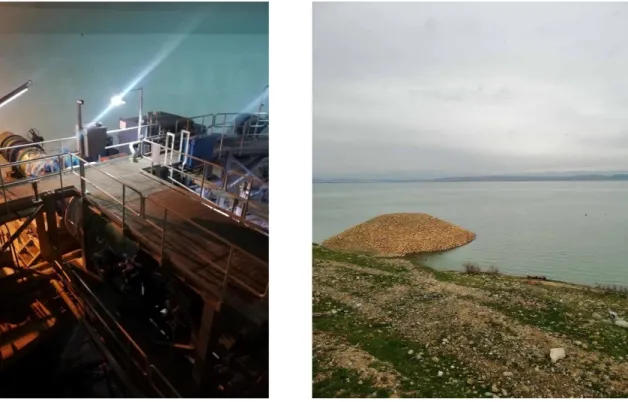
canal to intersect again with MOD at the 86.1km distance. At the distance of 165.5 kilometers there is the pumping station (PS 2), which contains 19 metric pumping units to raise water through pipes passing over the structure of a bridge over MOD, which is 3 pipes with diameter of 1.6m, followed by the intersection of the canal with the Um Al-Ma'arik Canal at a the 169.35km distance, Um Al-Ma'arkik Canal crosses Basra Water Canal through box culvert. The canal reaches at a distance of 227.75km to the storage basins (R0), which were built for water storage to avoid the impact of water shortage during a malfunction in the operation of the canal, as it initially built a basin with capacity of 750,000 cubic meters, and later another basin built with capacity of 5 million cubic meters. From the basins, the canal extends to its end at 238.5km east of Basra International Airport, where Basra water directorate facilities are. Shapes indicate a chart of the path of the Basra water canal, and storage basins at the end of the canal. Figure 4 shows a general outline of Basra Water Canal. Figure 5 shows a general view of R0 reservoir.
Figure 5: General view of R0 reservoir. (Source: [1]).
For Basra water canal, 200km were lined with concrete, while the rest were lined with good soil due to the gypsum content of the soil. The total discharge of the canal is, as mentioned, 21m3/s, including 5m3/s for the city of Nasiriya, 1m3/s for the city of Souq Al-Shouyokh and 15m3/s for the city of Basra. The period after 2003, the
canal suffered a lot for several reasons, where due to the incorrect maintenance of parts lined with good soil, this caused leaks and collapses in the sections of the canal, the canal itself was subjected to abuses by many parties. This led the water treatment stations to rely on the withdrawal of water from the Shatt Al-Arab again [3, 7, 4, 15].
13. Conclusion
Although there are millions of dunams served by irrigation and drainage network along Tigris river main reach, there are some points could be distinguished as a mutual aspects between the projects of Irrigation in this boundary:
1. Projects upstream Samarra Barrage depends mainly on pumping, while the projects downstream depend largely on the gravity water supply as a result of main barrages function, like Samarra, Kut, and Amarah Barrages. 2. Projects downstream Kut Barrage has a less relatively development
comparing to other lands upstream Kut Barrage.
3. Although its importance, Shatt Al-Basra project not implemented yet with all required infrastructure.
4. There are major needs to carry out reforms and rehabilitation in the existing projects.
References
[1] Resources, M. of W. (2019). Ministry of Water Resources Official Page on Facebook Available online: https://www.facebook.com/waterresources2/ (accessed on Jun 14, 2019).
[2] Resources, M. of W. (2005). The Encyclopedia of Irrigation in Iraq, February 1918-February 2005.
[3] AL-Simawi, H. (2010). Irrigation and Drainage Projects in Iraq.
[4] AL-Simawi, H. (2011). Irrigation and Drainage Pumping Stations in Iraq (in Arabic).
[5] Sousa, A. (1966). Baghdad Floods in the History: Volume 3 (in Arabic). [6] Board, S.A. (1977). Large and Medium Agricultural Projects (in Arabic). [7] AL-Simawi, H. (2014). Irrigation Regulators in Iraq until the end of the year
2013.
[8] Sousa, A. (1948). Irrigation of Samarra during Abbasid Khalef: Part 1 (in Arabic).
[9] Ministry of Irrigation (1984). 7 Nissan Project, Phase I, Volume 3.
[10] Designs, D.G. of E. (2008). Feasibility Study of Middle Tigris Irrigation Project (in Arabic).
[11] Macdonald, S.M. (1971). Badra, Jassan, Zurbatyeh Irrigation Project: Design Report.
[12] AL-Simawi, H. (2011). Large Main Drains in Iraq and their Status until 2011. [13] Macdonald, S.M. (1967). East Gharraf Irrigation and Drainage Project:
Planning Report.
[14] Al-Hakeem, A.H. (2015). Studies in Iraqi Agriculture: Part 2 (in Arabic). [15] Ministry of Irrigation (2001). The Implemented Projects from 1/1/1996 to
1/6/2001.
[16] Directorate General of Irrigation (1954). Report about Directorate General of Irrigation Works for Five Years from 1949 to 1954 (in Arabic).
![Table 1: Pumping stations in Ishaqi project. (Source: [4]).](https://thumb-eu.123doks.com/thumbv2/5dokorg/4268849.94640/7.813.82.738.293.978/table-pumping-stations-ishaqi-project-source.webp)
![Figure 2: Map of Dalmaj Irrigation Project.[2]](https://thumb-eu.123doks.com/thumbv2/5dokorg/4268849.94640/14.813.107.707.248.974/figure-map-of-dalmaj-irrigation-project.webp)
![Figure 3: East Gharraf project and its development plan. (Source:[13]).](https://thumb-eu.123doks.com/thumbv2/5dokorg/4268849.94640/16.813.73.769.131.551/figure-east-gharraf-project-development-plan-source.webp)
![Figure 4: General outline of Basra Water Canal. (Source: [1]).](https://thumb-eu.123doks.com/thumbv2/5dokorg/4268849.94640/24.813.110.704.424.782/figure-general-outline-basra-water-canal-source.webp)
![Figure 5: General view of R0 reservoir. (Source: [1]).](https://thumb-eu.123doks.com/thumbv2/5dokorg/4268849.94640/25.813.107.706.107.442/figure-general-view-r-reservoir-source.webp)
