LANDSCAPE ECOLOGY SYMPOSIUM
FIELD TRIP
Central Plains Experimental Range
Long Term Ecological Research Site
,
.-(
\..
WYOk lNG . NEBRASKA
_._
.
_._
.
_
.L·
_·
1
D--~---...
('-'-
'-
'
-
'
-COLORADOi"",
. KANSASI
"
.
'.
- ' - '- ' - ' - ' ...,·-1.·0KLA·HOMA·-f-
.
_
. _ . ,
NEW MEXICOi
i
i
TEXASi
LEGENDM,L,H Modrrole,lighl, heavy
herbivor~
/treotmcMs / W,$ Winler,Summer herbivore / rr". olmenlS / / / - / /
'I
/ _.
...
..
/ / / / ;0 II / / LS / / / I I I.
MW I I :2 ARS HOn II
MS HWILW MW 11 112eSJ
I I I 21 22 2 3 24@
\,.T ....®
HJl LS HS (!) 27 @ @ 28 26 25 3-1CENTRAL PLAINS EXPERIMENT RANGE:
6
---,
I:,
_ _ _ _ J ,,
PAWNEE NATIONAL GRA~SLAND,
, ,
,
I
,
,
\
\
I HS 5 I I Ii
LS I 7 MS ___ 8 ___ I I I 18 17 19 20 30 29 31 32\
SI-IORTGRASS
\
"'"
""PET :r: ~ Il"
:
X
\
\
-lI
:
X
X
,:1, ~, ,I.:X
:1.1
:
X
:
X
:X,
OXlA,
(xxX
..
WX:'
IU IXX Fig \-". I t>- Im.Q
:>,,1 IXX IXXXI
:1
IXX:1
c"I
.
~'n
:
X
:,
u
\:1
\ ~m
.
:
m
I'"
w ~ "-ex w>-~
z: u Go / / \ I \ I "-I',.tV
PPT I \ / "-/,
/ "-- _ /'-° J F M A f 1 J I A S O I J D
75
--:;iSH
-~ = ~:,s
>-G5 '-'"'"
~25-1-I
I
\ ~.~::n
:x
II. . ~X·:X
.):, :X
\ . I iX')
il I I"'
.
,'Q-:\
m
I I I ~ ~ .\L_;-
_
.
\ \ I0:Y~~((js#.!l1:
\
I . :::::::::::::,<h·-·!
~
::::}<}:
III
I~
'II
III'. "II i I
I
I
I
'I
I
rI
'I
_ :1 I l it 1'1
r
I
a
~:-:,:":,
:I
L.!....t!ill.11
...L1
.!!1llL
i1i
...LE!!L,:i .l...!O!lLI
,
!
_
'.1-',; I.HJ.Q IU-\I,..) U.l..;3l~ >l!J..o
t ·
~~\
P
RECl?TI
ma:l
SIZE cuss
b)
.. -
"- -_.--DisLribntion of northern and southern mixed praj ri0. and
sho rtgrass steppe.
~ Northern mixed prair.ie
[}:
;
:;:j
Southern mixed prairie•
CHARACTERISTICS OF THE
SHORT GRASS STEPPE
AREA: 280,000 Square Kilometers
LOCATION
:
West-Centra
l
Great
Plains
of the U
.
S
CLIMATE: Temperate Semiar
id
LA
N
D USE: Rangeland (50%) and Cropland (50%
)
Rangeland dominated b
y
nati
v
e shortgrass
e
s
VEGETATION OF THE SHORT GRASS STEPPE
UPLANDS
:
Bouteloua gracilis
Buchloe dactyloides
Opuntia polyacantha
SWALES:
Bouteloua gracilis
Buchloe dactyloides
Opuntia polyacantha
Agropyron smithii
SANDHILLS:
Artemisia
filifolia
Calamo
v
ilfa longifolia
Andropogon hallii
Schizachyrium scoparIus
CROPLANDS: Winter wheat
Alfalfa
Corn
I' I,
1
1
t
:i ,. ;;". .~.
r ! ~~g. 2.- - -
-
.-
-
- --'-. -~.-
---:-7..
" o Cosper 1 SOUTH DAKOTA~---
.
~,
I,
WYOMING , " . 35~ 345 399 37loSc:ottsbluff , 373 _ ' . 417'12 414 NEBRASKA :" .11 . ... 1. '_, ~ , .. \1 .- . 3~3 475 --.-Chey~ne. ~60 2~9,-- .. , -- 0 1J:tD .. ~ga6 45 .North Plotte
~" • . 3 7 9 " -
-'4421
Fort Collinso 285 ~96 467 :.,/ 310 Sterlin" 483 467 292, " 148 335 4373"
---Leadville • 357 424 343 368 27. 384 472 1432 300 306/ L~ Junto 429,
328 I 401 • Hoys 526 KA N S AS'0_
-Gorden City-_ ____
I
495:::::::-::::>'-14
424--
389 ~ 7 ---..~ 503 _ _ _ _ _ _ _ _ 447- 526 516 452'0'
373 Botse Ctty 457 ---401 :358 .67 563412/
399 • Santa Fe.,.
.,.
OKLAHOMA Tucumcari 310: 384 399/ 442 439 343 434"6
4.3 5'6 • Amarillo 348 386 ·Clovis "2I
43. NEW MEXICO 366 495 1 384 I Lubbock.467 368I
450 640 ---MEX...'~CO 406 • Clinton.
) TEXAS • Abilen. ',~:-.. ~: I·' SCALE , . . . I,-OMET[ItS o '00 I~ • .. tI' , , • i i i...
5CollE !I( M!lES
I
'"
Geo~raphic distribution of amounts of annual precipitation in the Shortgrass Steppe region
-ryo~ NG
fig. IV.I. Isolines of aboveground net primary production for the Shortgrass Steppe
79
APPENDIX 4
DESCRIPTION OF Tlffi CENTRAL PLAINS EXPERIMENTAL RANGE Location
The LTER project at Colorado State University is located at the Central Plains
Experimental Range (CPER) in the western division of Pawnee National Grassland (Fig.
1). The western division of the Pawnee National Grassland is 42,700 ha and the CPER
encompasses 6,280 ha.
The CPER is 19 km northeast of Nunn, Colorado, and 40 km south of Cheyenne,
Wyoming. The Range was established in 1939 to answer questions which were important
as a result of the drought of the 1930's. A number of pastures were set aside for
long-term experiments, and a large number of scientific publications have resulted.
Twelve half-section (129 ha) pastures were assigned four each to heavy, moderate, and
light summer grazing. In 1958 two of the replicates were changed to winter grazing.
Each of these and several other pastures also have at least one exclosure of 0.5 to 2
ha excluding livestock grazing since 1939. Permanent quadrats have been established
in these pastures, and in most years composition of vegetation has been measured.
All of the Central Plains Experimental Range is available for use in the LTER
Program, but some is dedicated to ongoing studies conducted by the Agricultural
Research Service (ARS) (Appendix 7). The Pawnee National Grassland, as mentioned
above, is available for extensive studies which require a great deal of land area but
do not require rigid control for experimental purposes. The LTER program will assist
investigators in securing cooperative agreements with the U.S. Forest Service for use
of these lands. The CPER, on the other hand, may be utilized for intensive studies
which require greater control.
A broad form of cooperative agreement has existed between the ARS and Colorado
State University (CSU) for many years. Under this agreement CSU scientists have
cooperated in many research projects on the CPER.
WYOMING NEBRASKA '-~;;.;.o...~~l i!!'TY'~!!!:'-! en,. W . 1 -G~.~;;:o' j-_._._._._._.- . COL.ORADO NEW MEXICO I I I KANSAS OKLAHOMA 1-- .- .- - ., TEXAS I i I I
80
Within the CPER was located the
Program (IBP) Grassland Biome study.
in ecosystem research at the CPER.
Pawnee Site of the International Biological
From 1966 to 1974 the IBP Program was involved
In 1968, a cooperative agreement was signed among ARS, CSU, and the IBP's
Grassland Biome Program (see Appendix 7). The agreement permitted IBP to conduct
grassland research on a portion of the CPER and provided for mutual cooperation. The
agreement also permitted the construction of needed facilities on the CPER. These
included an office-lab-cafeteria, storage shed, dormitory, residence, barn, and
corrals. This agreement was amended in 1975 when the IBP program was phased out and
is currently the agreement of record.
Under the auspices of the US/IBP Grassland Biome study and subsequent NSF
funding, interdisciplinary teams have analyzed the fundamental structural and
functional characteristics of the shortgrass steppe ecosystems at CPER. These studies
included measurements of the structural aspects of all trophic compartments, their
variation through time, space, and under stress (grazing, water, mineral nitrogen,
herbicides, pesticides) as well as a broad array of studies relating to ecosystem
processes such as primary production, secondary production, energy flow, nutrient
cycling, and abiotic and biotic control.
Climate
The precipitation variability (in time and space) is probably the outstanding
characteristic of the semiarid continental climate. The mean annual precipitation is
309 mm (12.2 inches) based on 30 years of data. May, June, July, and August tend to
be the wettest months. These 4 months usually account for more than 50% of the annual
precipitation. Through regression analysis it has been found that summer precipitation
explained 89% of the variance in annual precipitation while winter precipitation
accounted for the other 11%. This variation is explained by the frequent occurrence
of convective activity in the area during summer months. Northerly flow of maritime
tropical air combines with intense solar heating and orographic influence over the
mountains to generate thunderstorms which move in an easterly direction over the
grasslands beginning around noon each day. The winter climate is dominated by the
presence of continental polar air masses and very few storms moving over the area.
Storms which pass over the Rocky Mountain region lose most of their moisture over the
mountains; consequently, dry, sunny days are common in winter. The winter storms
which do occur have little effect on the mean water balance of the region. This is so
because high insolation, moderate to high winds, and warm daily air temperatures
combine to sublimate much of the snow. Major storms, defined as greater than 2.54 cm
(1 inch) of p~ecipitation, account for 74% of the variance in summer precipitation and
only 16% of the variance in winter preCipitation.
The large diurnal variation in air temperatures is a notable characteristic of
the steppe climate. Average diurnal variations are between 17° and 20°C (30° and
35°F), with variations up to 34°C (60°F) possible ill late summer. The lowest average
monthly maximum temperature is 7°C (44°F) (January and December) for approximately 30
years of data. The highest average monthly maximum temperature is 31°C (88°F) (July).
The lowest and highest average monthly temperatures are -12°C (lIOF) (January) and
12°C (54°F) (July), respectively. The median frost-free period is 128 days.
Another important characteristic of the grasslands climate
moderate to high winds throughout much of the year. The period
experiences noticeably higher winds than tbe remaining months.
plays an important role in the redistribution of snow following
resulting winter water balance of the region.
is the presence of
December to ~jay
This characteristic
AI 20 C 40 60 80 ....
-80GR OPPO ARLO __
<
10;\ oom 15% clay 17% clay OTERO SL ----CAHE OPPO AI -1-2 % om 10% clay\I
18% clay B2 "\, r I C~
'
::~~~I~
17% clay VONA SL -AGSM BOGR CAHE ,.. )3% om AI . i.fuL: -":r -. .,-A 25% "=t,!{; clay 81 82 34% clay AL81NUS SCL AGSM BOGR 80GR 80GR OPPO CAHE ARLO ARFR3% om AI
<
1% om AI I%om AI~
f
40% clay AC ' ... IO%clay.-
31 % clay I \ ~,<\ I
, " B2 16% clay ' , -=:};, 7 ....
~ ~ I, ( C '.
I~II
'""" >' , .. ~f>:' 81 R 'f,.~ ! .. ~. .. C :U . ~f:1:~~\
·
1
34 % clay..
' ,'.
/::(1 82,
f
.
.
..
'.
R /;;(~: ~.r.:~:d
, " " .·1·)~..
ALBINUS MIDWAY TERRY SCL SiCL FSLWater and Nitrogen Induced Stress
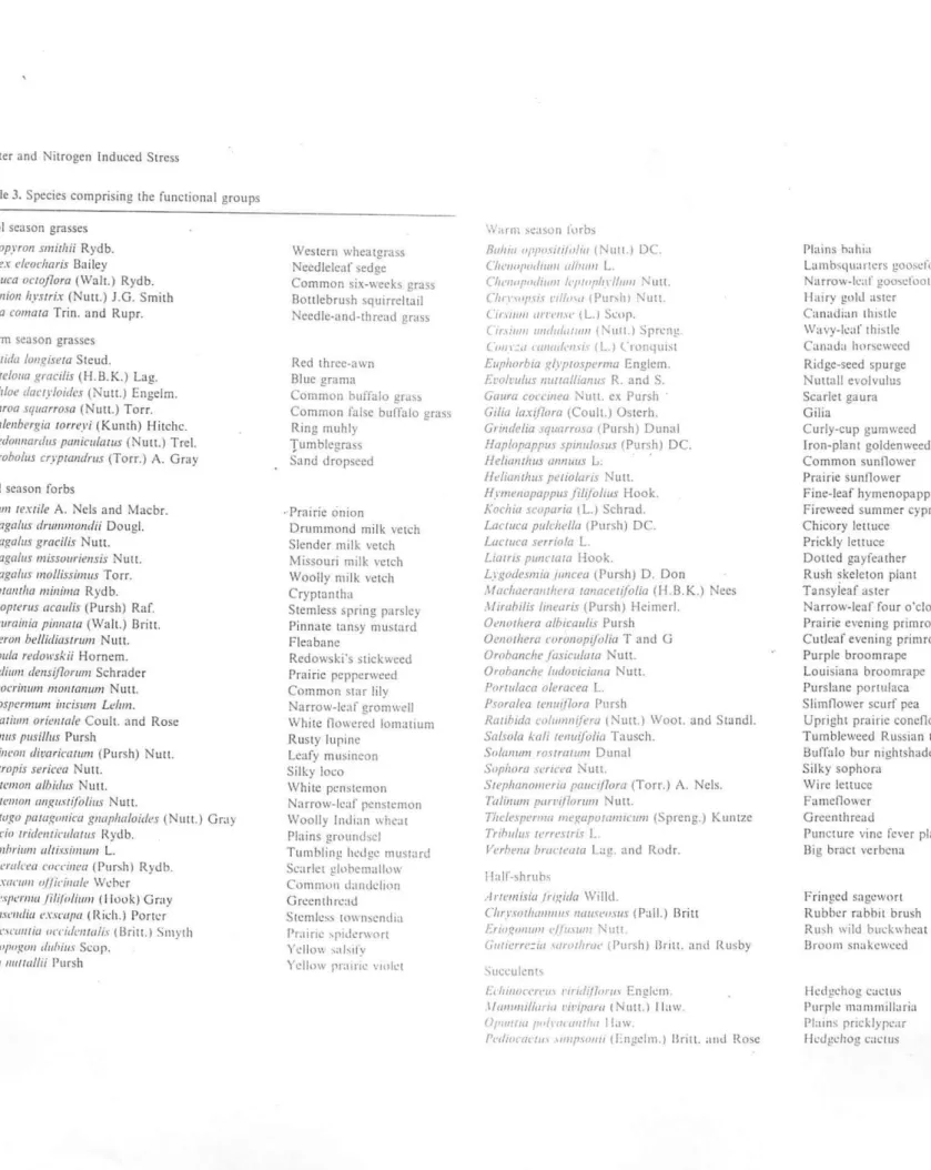
Table 3. Species comprising the functional groups
Cool season grasses
Agropyron smithii Rydb. Care.'!;. t'/eoeharis B:!iley
Fl'Slllca oetoflortl (Wah.) Rydb. SilUniOIl hysnix (Nun.) J.G. Smith
Stipa comU/a Trin. and Rupr.
Warm season grasses
..Iris/ida /ollgisl!ta Steud.
HOllle/ollll gracilis (l-I.B.K.) Lag. Buchloe doety/oidt,s (Nuu.) Engelm.
.I/ullrotlsqulIrrosn (Nuu.) Torr.
J/Ilh/ellbC'rgia torrey; (Kunth) Hitchc.
SehedOllllarilll5 pllnicll/(lrw' (Nutt.) Trel.
Sporobo/IIS crypwildrus (Torr.) A. GrilY
Cpol season forbs
Allium texlile A. Nels and Macbr.
.~51ragalus drummondi; DougJ.
Astragalus gracilis Nun.
Astragalus missuuril!lI.ris NutL
Asrraga/u.r 11I01li.r:ri1llUS Torr.
CrypulIIllw millim(l Rydb.
Cymoplt'rus llc(luli.r (Pursh) Raf.
Descurailli(l pil/l/{//(J (WaIL) BritL
Erigeroll belliil;aSlrtllll Nutt.
Luppu/a redoll'sJ.:ii Hornem.
LepilJill1ll deruiflorum Schrader
L(,IICO('l'il/li/1/ I/wl/Wl/l/m Nut!.
Lithosf/l·mwm illcislllll Lt!IIIII.
LOIII(l(illlll oriel/Ill/I? Coult. and Rose
LI/pill/IS pl/silllls Pursh
\/uSil/('(J}/lJiUlIril'llfllm (Pursh) Nun.
Oxyuopis sl?ric('(I Nun.
Pel/.r/l'/IIQn albidm Nun.
P"lIsll'II1(}1I (lI1gll.Hi/'o/iIlS Nutl.
PfllllWgU p(lfagollil'll gl/l/pJmloiril's (Nutt.) Gr:!y \'l'I/('cio trir/C'lIliclllatll.f Rydb.
"iisymhl'illll/ lIlli.Hill/lim L.
'ip/wallln.'(1 ('(1("('1/1('(/ (Pursh) Rydb.
TUrt/xIICIIIJI ol(;dllille Weber
n/j'h'.~pe/'llIll/i'liJ(l1i1/1I/ (I [ouk) Gmy
Ton'/Ix('"dit, ('.nmplI (Rkh.) Porter
(rmh'.It'wlfill O(TidI'IIW/i.l· (Uril!.) SlI\vth
rm,t:tlfllIgrm dllhiu.~ SI:Op. .
l'io/1I mlfwllii l'ursh
Western wheatgrass
Needle1caf sedge
Common six-weeks grass
Bonlebrush squirreltai!
Needle-and-thread grass
Red three-awn Blue grama
Common buffalo gra~!I Common fulse buffalo grass
Ring muh[y
Tumblcgrass
Sand dropseed
. Prairie onion
Drummond milk vetch Slender milk vetch Missouri milk vetch Woo!!y milk vetch Cryptantha
Stemless spring parsley
Pinnate tansy mustard
F[eabane
Redowski's stickwced Prairie peppcrwecd Common star [ily Narrow-leaf gromwcll
White nOllered IOrnatlum
Rusty lurllne Leafy mU!lineon
Silky loco White penstemon Narrow-Il';l!' pcnstt'mon
Woolly Indian whl'at
Plains ground!lcl Tumbling hedg!.! mustard Scarlet glllbemallow Commun dandelion Grccnthn:;IJ St!.!ll1k:-.:-. town~endla Praim: 'pllli:rwon Yello\\ ~;d~I!'Y Yelhnv pr:llrle vlule!
W;mll ~..:;]son fllrb:>
8ahlll ojlpmllil/llill (NUll.) DC. Ch('IIII/IlIdllllll a/hulII L.
C/It'lIfll'rldiwll 1t'/I/fIJl/n'II",'1 NUlt. CiIfI'IOI'SIS 1'I11f/11I (Pur,h) Nun.
01'1111111 urn'lI\(' tL.) St.·IJP.
C'I'.I/IIlIIlIIldlll!l11l1ll (NUll,) Spn:n~
COI/I:" nllllll/(,l/li\ fl.1 ("runqll1st
Euphorbia glyplOsperma Englcm. Et'O/m/us llI11rnlliallllS R. and S. G(Iltrtl corell/eo NUlL ex Pursh Cilia /axi{lor(J (COU[L) Osterh.
Gril/delia .fqllarrosa (Pursh) Dunal Hap/opappus splIluloSliS (Pursh) DC.
lIelimulllls Ul/flIIIIS L. .
/ldiwllhlls petio/uris Nu{{. Hymellopaf!pus fi/~(ol/Us Hook.
Kachia scoparia (L) Schrad. Laclllea pu/dwllo (Pursh) DC.
LaclIIca .fnrio/a L
Li(/Iri.~ pIII/c/(ml Hook.
Lygotiesmi{/ IIII/cea (Pursh) D. Don
,lfachOl'rflllrhew ralll/eelijolia (II.B K.) Nees
Miwbilis IlIIe(lri.f (PurshJ Heimerl.
O"I/(ul!era a/biralllis Pursh
OCI/(}/hera (urollopiji)/ia T and G Orohanche fasicu/aw NutL Orohallche lut/ovicialla NutL
Porili/aca o/er(l(:ea L.
PJora/ca rCIlIlij70ra Pursh
Rallbuia ndulI/ll(/em (Nun.) WOOL and St:.lndl. Sal.rofll kali lel/lIifali(l Tausch.
Solalllllll rO.f/mllfm DUlliI[ Sophora seneea Nutt.
Sfl'plwnol/lI'ria pallel/lora (Torr.) A. Nels.
Talilllllll part'/f'orl/III NUlL
Thd('sperl//(/ megapUI/lI/Ilf!/IIl (Spreng.) Kuntze
Trihlllils rart'stris L
Vt!rhl'lll/ bmcll'tJra Lag. and Rodr.
II:dr-shrub ...
.. lrtl.'l/l/);a Irt~ida Wil[d.
Cftry.wIJwlIIlIl/.f 1/{111,1"('''.\II.\· IPaIL) Oritt
EriogoJ//(IIIl'lImlllll Nutl.
(illllerr(':iCl \lImllimt' (I'ursh) Bnll. and Rusby
Succulcnb
t'lllIIlIIn'/'('1II 1'lrufi{7"I'I/\ Englcm. 1/IIIIImil/ol'/II /'iI'if/am (NUll.) I taw. (J/IIIIIIIII l'O/rf/((lIItllfl 11.lw.
!'t·t/IO(,(Ic/II' .1/l1I1'\{1I/1/ tl:ngelrn.l Brill. anu Ros!.!
Plains hahia
Lambsquancrs goo~crool
Narro ... -Il'af gooscfoot 11.llry !:!Illd aster
Canadi:llI Illlstle
WavY-!c;l!' thi!.!lc
Canada IHlf:.ewccd Ridge-seed spurge Nutlatl evolvulus Scarlet gaura Gilia
Curly-cup gum weed
Iron-plant golden weed Common sunflower
Prairie sunOower
Fine-leaf hymenopappus Fircweed summer cypress Chicory leltuce
Prickly lettuce
DOlled gayfeathcr
Rush skelcton plant Tansyieaf aster Narrow-leaf four o'clock
Prairie evening primrose
Cutlcaf evening primrose Purple broomrapc
Louisiana broomrape Purslane portulaca
SlimOower scurf pea Upright prairie concOower
Tumbleweed Russian lhislle Burralo bur nightshade
Silky sophora
\Vir!.! !cttuce FameOowcr
Gre!.!lllhread
Puncture vine rcvcr plant
Big braci v!.!rbcna
Fringed sagewort
Rubber rabbit brush Rush wild buckwheat Broom silakewccd
Hedgehog caelus
Purple Illammill:lria Plains pricklYrcar
":
.-.'
480 SOIL SCI. SOC. AM. J .. VOL 52. 1988
T.ble 2. Areal exteut of PUs. lUld percentage of CPER occupied.
by each.
Lowland Slope Upland
pu % of total % of total % of total
ha h. ha I 38 2 171 9 1689 89 2 27 5 95 18 408 77
•
.71 32 795 54 206 I. 5 53 31 2. 1. 9. 55 6 375 '3 323 37 17. 20 9 152 74 54 26 0 0 Total 1116 22 1462 28 2571 501979). Radiocarbon dates were determined for two paleosols
after removal of all light-fraction material in an Nal solution of specific gravity 1.8. This was assumed to remove all
mod-ern roots and detritus. No further fractionation was per·
formed. Radiocarbon age was determined by Geochron Lab.,
Cambridge, MA.
The distribution of organic C mass is presented in tenns
of three general landscape components, herein referred to as uplands, slopes, and lowlands. Uplands included level
up-land plains and the summit portion oftoposequences; slopes
included the area between the shoulder and foots lope po
r-tions of toposcquences and terrace escarpments; and low
-lands included toeslopes, broad ephemeral stream courses, and other level, low-lying areas.
An electronic distance measure (EDM) was used to obtain
the distance between sites and across physiographic units.
These data were used to estimate proportions of uplands, slopes and lowlands within each unique PU (Table 2). The
area within each PU was estimated using a dot grid overlay
ofa 1:24000 map, at a resolution of 10 dots cm-'. Hectares
of uplands, slopes, and lowlands were derived for each PU
from the latter two estimates by multiplying the proportion
of each position along Ihe transect by the total area of the PU.
RESULTS AND DISCUSSION
Patterns of Organic Carbon Concentrations
Organic C concentrations in surface horizons of
CPER soils averaged 9.8 g kg-', with minimum,
max-imum, and standard deviations (SD) of 1.3, 35.9, and
3.2, respectively. Some variation was due to slope po-sition, although differences between positions of a
given toposequence may not be striking (Fig. 2). Ty
p-ically, surface (A) horizon organic C concentration did
not vary systematically among positions of a given
toposequence. Although toeslopes nearly always had higher concentrations than corresponding summits,
organic C concentration did not decrease at the sho ul-der or increase systematically downslope in most cases
(Table 3). Similarly, surface horizon texture and thic
k-ness were not well differentiated across toposequences. These results are in contrast to other findings (Aan
-Summit ShOJlder Backslope FOOlSlopeo ToeSlope
(g.kg·1)_ I. ~ 10. 15. 1 ~ lQ. l~ , 5 lO ,~ , 5 '0. 15.. 1 , 10 I~. 60 E 80 u at< , , , , J:. 100 -I"'OC"ke.' - - l 0. " BCkl o 120 .I-"""'--l 160 2Crkl '60 ,;'. :I
('\
1
28k lCrkl 2Cr1t2 \ ,,
,~,l. .~~,
I Bk \ , BCkl aCl< 2 2Crkl JCrk2 Bk BCkl BO 2 2Crkl ,,
~? " BlkbJ 200 JCrk 2 '0"" '00 10 ~o '00 10 50 '00 10 50 100 10 50 (., .)----, , '00Fig. 2. Organic C concentration and cumulative percent of organic
C mass as a function of deplh (or a selected toposequence.
dahl, 1948; Aguilar, 1984; Kleiss, 1970; Malo et aI.,
1974) and suggest that the role of water as the agent of differentiation is minimized in the present-day e n-vironment. Funher evidence for the importance of eolian processes within the shongrass steppe was
pre-sented in Schimel et a1. (1 985b), where the increase in fines downslope was found to result from the com-bined effect of an eolian footslope deposit and a re-cently denuded summit. Although some flow
down-slope apparently occurred at that site, wind was the
overall dominant process in determining soil distri-bution.
The decrease in organic C concentration with solum depth (Fig. 2) was uniform except where penurbed by
recent eolian deposition, buried soils, or lithologic dis
-continuities. All of these conditions were common at
the shortgrass steppe· site; two were reflected in the
soils of Fig. 2. The A 1 horizon at the shoulder con
-tained less organic C and more sand than the A2, sug
-gesting a more recent deposit, which has not
accu-mulated an organic C concentration comparable with
that of the A2. Although not dramatic in this example,
the increase in organic C concentrations in the Btkb I,
Btkb2, and Btkb3 horizons of the toes lope soil reflects
the influence of buried horizons, which were often found relatively deep in the profile. Organic C co
n-centrations in buried horizons were typically higher
Table 3. A horizoD organic carboD (00, sand coDteDt, and bOrUoD thiweea by elope poeitioD Cor each physiographic unit sampled.
Summit ShouJder BacUJope Foot.slope TQe$iope
pu DC Sand Thiclmess DC Sand Thickness DC Sand Thickness DC Sand Thickness DC Sand Thickness
gkg"' % em g kg-' % em g kg-' % em g kg-' % "0 g kg"' % om 1 7:i:2 (7) H:i:5 9~3 7::t;2171 71 :*:2 9~5 9:*:3171 71:*:7 15:1: 14 9:*:2 m 63:*:13 8~6 13:*:5 (6) 54::t;18 9=6 2 7::1:2 (2) 69::1: 13 13* II 10*3 (2) 60*17 14 * 1 8*1 (2) 58* 14 10:*:6 11 *3 (2) 61 :t: 2 12*4 19::1: 14(2) 52 ±22 10*8
•
8*2 (~) 68:7 9=5 8::1: 1 (5) 66~6 10*" 8*2 (5) 64::1:9 12 :1:4 9*4 (5) 69*3 12:1:3 12*5 (5) 60:t:8 17*7 5 15*4 (2) s7±4 9H 1O:t:3 (2) 67*2 14*2 8*0 (2) 65:1:6 9,2 7*2 (2) 70.:t:4 14 :1:5 8:1:2 (2) 68~' 14 *3 6 8*2 (5) 58±16 11 *11 6:1:3 (6) 6O:t: 15 12*8 8:t:316) 55:t:17 10±4 7 ± 1 (6) 60:1:7 8%2 10*4 (6) 52*8 8~I 9 8 (II 61 7 8:1:3(2) 66,. 9=6 7:i:l (2) 64*10 5~1 7::t;7 (2) 62::1:7 70' 11:1:8 (2) 57*15 6,3. ": " ... . . ~ :'.' ':.': .;' .. ; ... .. '. ... : ...
...
..
.
'" .' ... ... . ' ... .... ': .. :;.:.:.:.: " ;'- .:. '-' ... .:..
February 1985 SHORTGRASS STEPPE CATENA BIOGEOCHEMISTRY 277
Ustic torriorthent SUMMIT Ustollic haplargid Pachic orgiustoll
I
_F_O_O_T_S_LO
_P_E~
r
fI B" IIC IIIC Profile Description 130 m ---~--'-.... FlO. t. Horizonation of soils and topography of ashort-grass steppe catena..
are also found. These are generally saline or sodic and have distinctive vegetation. Large variations in soils occur along shongrass steppe catenas. with as many as six soil series and three soil orders occuning along
120-130 m slopes. Sorting of particles often occurs along
catenas, with sandy soils on ridgetops and clay loams
in lower slope positions, although aeolian deposits fre-quently complicate this pattern. The area is ideal for
studies of biogeochemical cycles in a landscape context.
The objectives of this study were (I) to describe the
nutrient and organic matter content of soils in relation to topographic position, and (2) to identify the mech-anisms through which erosion and runoff affect nu-trients and organic matter .
MATERIALS AND METHODS
Study site
All studies were conducted at the United States De
-partment of Agriculture-Agricultural Research Service Central Plains Experimental Range (CPER). CPER is located north of Nunn. Colorado. in Weld County (latitude 40048'2J"'N. longitude 104°4S'15"W). Ave
r-age precipitation is 310 mm/yr and mean monthly
temperatures range from - 5°C in January to 22° in
July. The site chosen was a nonh-facing hillside near
the head of a narrow drainage located in Range 66\V.
Township ION, Section 26. The base elevation ofthc
hillslope was 1641 m. with 12 m relief from base to
summiL The slope was 130 m long. The site was fenced
to exclude cattle in May 1980.
Three soils were found along the hillside (Fig. I).
The summit was a Ustic tomorthent fonned in ancient
coarse alluvium. The backsiope was a USlollic haplar~
gid, also formed in ancient coarse alluvium. The
foots-lope was a Pachic argiustoll. formed in recent fine·
textured alluvium. Terminology for slope morphology
follows Ruhe and Walker (1968).
The vegetation also varied along the catenary
se-quence (Stillwell 1983). Percent ground cover ranged
from 90-100% on the footslope to 30-40% on the
ridge-top. The perennial vegetation on the ridgetop was
dominated by Opuntia polyacantha (starVation
cac-tus), Aristida longisetum (red three·awn). and
BOUle-loua gracilis (blue grama). Patches of Muhlenbergia torreyi (ring muhley) and Stipa comata ( needle-and-thread) also occurred. The backslope was dominated by Opuntia. Bouteloua. and Buchloe dacryloides (buf.
falo grass). The dwarf shrub GUlerrezia sarOlhrae
(snakeweed) also occurred. The footslope was domi·
nated by intermixed stands of Buchloe and Bouteloua.
with large amounts of Carexfilifolia. An unusual growth
of the biennial forb Thelosperma fili/olia occurred on
the ridgetop and backslope sites but was not found in
the footslope.
Soil and vegetalion sampling and analysis
Aboveground live and dead vegetation on three 180 em diameter circular plots was clipped on 261une 1980
for aboveground biomass determination on each of three slope positions. Roots and detritus were removed.
from three 10 cm diameter, 20 cm deep cores per plot
by repeated flotation and filtration through a l-mm mesh screen. This depth increment included >90% of
total root mass. We did not attempt to separate live
from dead roots.
Three replicate 5.1 cm diameter soil cores spaced 20
m apart were taken for c.hemica.l and physical analysis
from each of three slope positions. Cores were subdi·
vided by genetic horizon as distinguished in the field,
and were taken to as great a depth as could be obtained. Total N in soil and plant samples was determined following Kjeldahl digestion using a block digestor
(Nelson and Sommers 1980). Digests were analyzed
for NH}o calorimetrically. Organic P was determined by the method of Saunders and Williams (1955), in
which paired samples are extracted with I maUL H:SO-,.
One of the pair is ashed at ~OO°C prior to extraction.
and the difference between the two is organic P. Total
P was determined by NaOH fusion (Smith and Bain
1982). Available P was estimated using an NaHCOl
extract (Olsen et al. 19 54). After removal of carbonates
with H:SO-,. soil organic carbon was determined by
wet oxidation with K:Cr:07 in a concentr:::ned H:SO~
H)PO-, mixture in sealed culture tubes containing an
N E
"-'!!:
70 15 _____ 1984 Average 1985 AveroQe >- 10 r-til Z W a c: w a. a. o J: til til <f c:'"
til c: W <Xl ::> :::>z
w oJ r-w w <Xl wz
:::>...,
A. ~ I ' " I 'b.. , , .0-'b... .tf ''b-- ... I " "'" I '<r' \ 5,
I \b-
_
"",-p
,
,
I 'b-_-<>... I ... / ... '0 0~~~~~~~ __ ~~~~~~~ __ L-~~~ 163 170177 184 191 198205212 219 226233240247254261 268275282 JULIAN DATEFig. 11.13. Grasshopper densities (fl/m2) during the 1984 and 1985 growing seasons.
300 280 260 240 220 200 180 160 140 120
-100 80 -60 -40-,
/\
20\
,
0 0 140 280 40 180 320 80 220 1983 1984 1985 JULIAN DATEFig. 11.14. June beetle numbers (n/trap period) for 1983 through 1985.
1
I. INTRODUCTION
Meaningful analyses and explanations of spatial heterogeneity, its temporal counterpart and the relationships among the various scales of each, are prime
deficiencies currently impeding the progress of ecosystem ecology. What is the origin
of the spatial patterns in landforms, soils, and vegetation that exist in the
Shortgrass Steppe? How are those patterns maintained? Which processes are primarily
pattern generators? Which processes are primarily pattern neutralizers? What are the roles of punctual versus gradual processes in the origin and maintenance of patterns? How are the answers at one time or space scale related to the answers for a different
scale? The spatial and temporal scaling issues inherent in these questions will guide
the Central Plains Experimental Range (CPER)/LTER program for the next four years.
LTER I was organized around the theme of the interplay among geomorphological, pedological, and biological processes in shaping the structure and dynamics of Shortgrass Steppe landscapes. Current work was woven into a foundation provided by the 5 Core Topics from the LTER Request for Proposals. We expanded these
5 topics under LTER I to include: (1) Interrelations among geomorphology, landscapes, soils, and vegetation structure; (2) Weather and atmospheric deposition; (3) Erosion and sedimentation; (4) Soil water dynamics; (5) Primary production and plant nutrient dynamics; (6) Elemental cycling and organic matter; (7) Secondary production and
population dynamics of selected consumers; and (8) Specific disturbances.
Results from the first four years have, in the balance, raised more questions about spatial and temporal pattern than they answered. Our original catena modell was
based upon classic soil science concepts and proved to be too simple. While we found
textbook examples of catenas at several locations, soils and vegetation at other
lWebster's definition of catena is a connected series of related things. In our usage the related things are soil types and associated vegetation.
2
locations refused to fit the model. Our ideas about the fluvial origin of landforms
at the CPER have also proven difficult to substantiate with data. Finally, the
relative uniformity of A horizons from location to location is a puzzle. The
resolution of these instances of lack of fit with current models was a major
breakthrough for our concepts about semiarid regions. Research proposed under LTER II
is planned to reconcile these differences over a range of spatial scales.
An important feature of the vegetation at the CPER and throughout the shortgrass
region is the conspicuous pattern at small (0.1 m2) to medium (several m2) scales.
Analyses of this pattern during LTER I could not link it to soils. If spatial
variability in soils is not the explanation for these patterns, what is? Current
patch dynamics theory (Watt 1947, Shugart 1985) suggests the idea of gap phase
replacement and small-scale events, which result in the killing of individuals of
Bouteloua gracilis (blue grama), as a likely source of this pattern. Does the killing
of an individual of ~. gracilis initiate a sequence of events belowground in a
shortgrass plant community, that is analogous to the events that occur aboveground in
forests? Is the pattern that is so obvious in shortgrass plant communites the result
of gap dynamics? We propose to test this idea under LTER II and evaluate the range of
spatial scales over which gap phase replacement is an important pattern-generating
process.
This proposal is organized around nested hierarchies. The long-term nature of
the project defines a nested hierarchy of time (viz., decades within centuries, years within decades, months within years, etc.). Because we are dealing with a range of time scales, we are compelled to consider a range of spatial scales. These too, have
been conceptualized as a nested hierarchy (Fig. 111.1). Finally, we have organized
our ideas and hypotheses around the Core Topics for LTER. Within each of the Core
Topics the organization is according to spatial scale. The conceptual development for